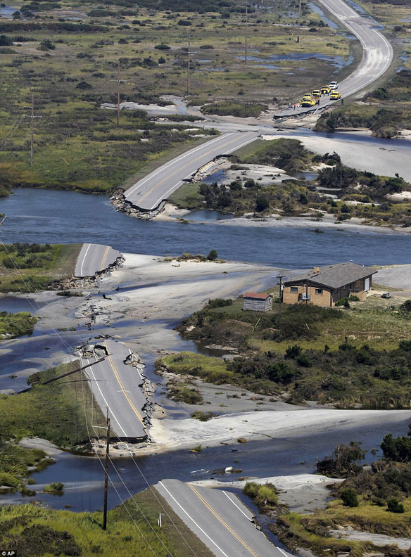

North Carolina. Highway 12 north of Rodanthe on Hatteras Island, as seen on Sunday, Aug. 28, 2011, was washed out by Hurricane Irene. Photo source: State of North Carolina
WATCH A BBC Video: Post Tropical Storm Impacts
Causing unprecedented flooding in several states, post-tropical storm Irene has killed 40 people in the US, and authorities are warning that flooding could continue for up to three days in northern states…
US rescue effort stepped up after Irene, AFP
Photos Gallery By PSDS
Personnel from the Program for the Study of Developed Shorelines (PSDS) are actively surveying the North Carolina coast following the passage of Hurricane Irene. Center Director Dr. Rob Young completed a surveillance flight of the northern Outer Banks Sunday, August 28, 2011; View Photographs and first report of storm impacts.
Hurricane Irene Flooding, USGS
USGS scientists are already assessing landslide potential for areas in the path of Hurricane Irene’s rainfall.
Hurricane Irene Comes Ashore: National Geographic Photos Gallery


