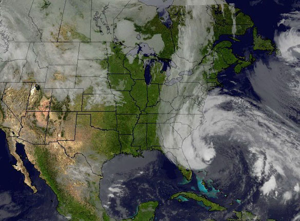

This image was created combining NOAA’s GOES-13 and GOES-15 satellite imagery on Oct. 27 and shows the cloud cover from Hurricane Sandy interacting with the long line of clouds associated with the cold front approaching the eastern U.S. The composite image was created using SSEC’s McIDAS software and NOAA’s GOES imager satellite imagery. Captions and Photo source: NOAA / UWI/ SSEC / NASA
Excerpts;
After causing heavy damage and at least 58 deaths in the Caribbean, Hurricane Sandy is expected to make landfall on the East Coast by Tuesday. No one can be certain how powerful it will become, but the signs are ominous.
Sandy is expected to strike the Eastern Seaboard near the Delaware coast, then hit two winter weather systems as it moves inland, creating a hybrid monster storm…
NASA Satellites See Sandy Become a Hurricane Again and Strong Winds Expand
Sandy weakened to a Tropical Storm and strengthened back into a hurricane early on Saturday Oct. 26, and its pressure was dropping, meaning that the storm is intensifying as it becomes an extra-tropical storm. NASA’s TRMM satellite identified heavy rain falling within the system and NOAA’s GOES satellites provided a picture of Sandy’s massive size.


