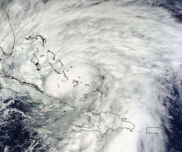

NASA’s Terra satellite flew over Hurricane Sandy around noon local time on Oct. 25, it captured a visible image of Hurricane Sandy that showed the large extent of the storm. Sandy has grown since the morning hours on Oct. 25 by about 120 miles in diameter according to satellite data. Captions and Photo source: NASA
Excerpts;
Hurricane Sandy grew into a major potential threat to the Northeast on Thursday after hammering Cuba’s second-largest city and taking aim at the Bahamas.
Strengthening rapidly after tearing into Jamaica and crossing the warm Caribbean Sea, Sandy hit southeastern Cuba early on Thursday with 105-mph winds that cut power, damaged homes and blew over trees across the city of Santiago de Cuba.
The storm has a 90 percent chance of smacking the Northeast and mid-Atlantic early next week with gale-force winds, flooding, heavy rain and maybe even snow, forecasters said Thursday…
Hybrid of Sandy, winter storm threatens East Coast
Government forecasters say a big storm that they’re calling “Frankenstorm” is likely to blast most of the U.S. East Coast next week. The storm is an unusual mix of a hurricane and a winter storm. The worst of it could be focused around New York City and New Jersey. And it is likely to hit during a full moon when tides are near their highest, increasing coastal flooding potential, NOAA forecasts warn.


