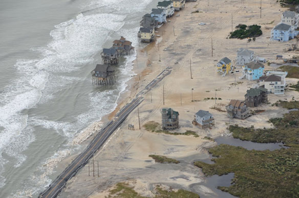

Aerial pictures of North Carolina’ s coast, after superstorm Sandy devastated the area. Highway 12. Photo courtesy of: © A PSDS / WCU Photo Gallery.
View more aerial pictures of North Carolina’s coast, after superstorm Sandy devastated the area: © A PSDS / WCU Photo Gallery.
View More: PSDS Photos gallery, Picassa Web
Program for the Study of Developed Shorelines (PSDS), Western Carolina University
Other Recent Aerial Views From The East Coast:
Sandy From Above SlideShow, Yahoo News /AP


