


By Norma Longo, Nicholas School of the Environment, Duke University, Durham, North Carolina
Cornwall, the southwesternmost county of England, is famous for Land’s End, St. Michael’s Mount, St. Ives, numerous beautiful beaches, and a past history of extensive mining of a variety of minerals, particularly tin and copper (1). In Cornwall, some beaches and mining activities are so interconnected that it’s practically impossible to study one without garnering some knowledge of the other.
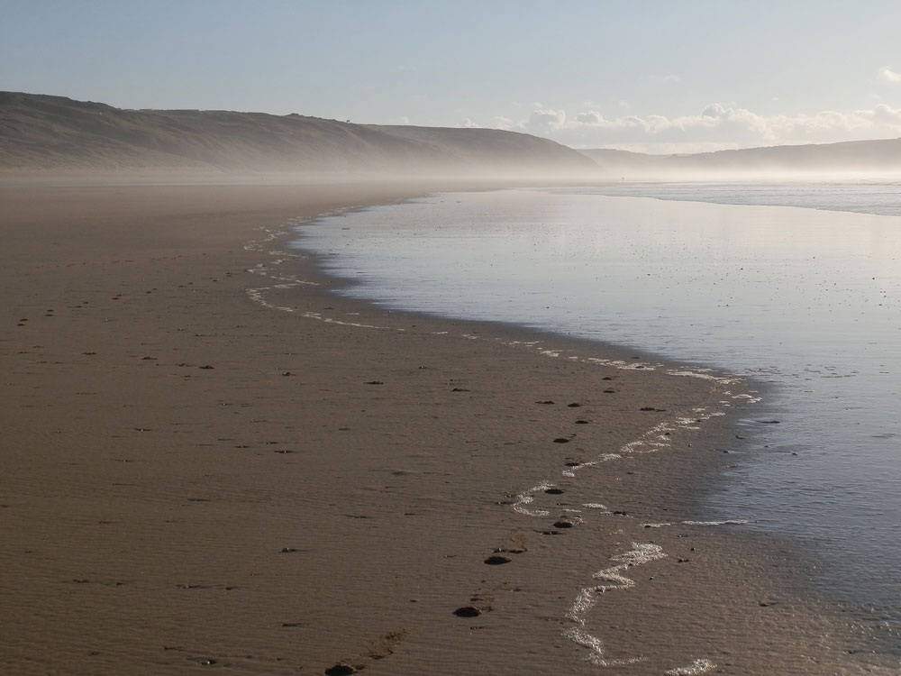
Facing the Atlantic Ocean and Perran Bay on the north coast of Cornwall is Perranporth Beach, one of the best in the country, a popular beach for surfing, rock- pooling, horseback riding, walking, and engaging in various other sporting activities. Recently, online reviewers ranked Perranporth as the 13th best beach in the UK (out of over 300 beaches) in the 2013 Travellers’ Choice Beach Awards (2). (Figure 1 – Perranporth Beach.) The beach can be very crowded in primary bathing times (July and August) but can seem practically deserted during other parts of the year. The wide stretch of sand is a great place to play fetch with dogs, and dogs are allowed all year, with leash restrictions only during July and August on the main, busiest part of the beach, known as Perranporth Village End. (Figure 2 – dogs on beach)
The beach is oriented northeast-southwest and the coastal setting includes dunes, cliffs, tidal pools, and a stream mouth, plus various reminders of Cornwall’s ubiquitous mining history. As with most seaside towns, tourism is important to the area, with The Watering Hole, a popular pub located right on the beach, plus a variety of hotels and B&Bs available nearby. The Royal National Lifeboat Institution (RNLI), an almost all-volunteer life-saving force, has a lifeguard station situated on the beach, with safe swimming areas patrolled and flagged as needed during the busier months. (Figure 3 – RNLI)
The beach lies between two rocky headlands, Ligger Point to the northeast and the smaller Droskyn Point toward the southwest. The entire county is underlain with mine shafts and tunnels, and at the site of Wheal Droskyn at Droskyn Point, the Millennium Sundial was constructed overlooking the beach, displaying the fact that Cornwall time is about 20 minutes behind Greenwich Mean Time (3). Inevitably, time and tide wait for no one. When the tide is out, Perranporth Village End to the southwest and Perran Sands to the northeast are combined into a beautiful 3-mile (5 km) stretch of light tan sand about 770 yards (700 m) wide, but at high tide this length of beach is split into two separate areas by rocks (called Flat Rocks) protruding onto the beach. (Figure 4 – Flat Rocks) The incoming tide covers the flat beach quickly and cuts off passage via the beach from the Ligger Point headland to the widest section of the beach in front of the pub and the car park.
“Mining in the area of Perranporth Beach was what used to bring people here, but now it’s a surfing paradise and a popular tourist holiday spot.”
— Norma Longo
Perran Sands is backed by cave-riddled cliffs and rocky shoreline features at the base of large, vegetation-covered sand dunes, the Penhale Sands (also called Penhale Dunes and Gear Sands). (Figure 5-dunes-WateringHole-river) These dunes are mobile to some extent, encompass over 1500 acres (625 ha), and stretch for about a mile inland (4,6). In addition to animals such as rabbits, Shetland sheep and ponies, the dunes host a variety of dune grasses, wildflowers, and insects (e.g., numerous butterfly and moth species). Unfortunately, they are sometimes marred by commonplace litter strewn where beachgoers have picnicked and left their debris. A golf course and an army training camp are located atop the dunes, which are also used for orienteering competitions. A portion of one of the UK’s numerous public footpaths, the South West Coast Path, runs along the top of the dunes and cliffs, with part of the path on the beach itself (5). According to Cornwall Council, the Penhale Sands are the highest dunes in Britain, reaching to a maximum of about 300 feet (90 m), with a depth of nearly 165 feet (50 m) of sand before rock is reached (6).
The dune field is designated a Special Area of Conservation by the European Union (EU) and an Important Plant Area by Plantlife, a wild plant conservation charity based in England that describes the area as being part of the most extensive dune system in Cornwall. The dunes, composed of windblown calcareous shell fragment sands which create highly calcareous soils with little organic content, extend about 2.5 miles (4 km) in length. Because of the beneficial lime content, these dune sands were mined by farmers in past centuries, for use on their lands (7). Plantlife also notes that four very rare plant species (Babington’s leek, wild leek, fragrant evening primrose, and Shore-dock) grow at Penhale Dunes, and the dunes are also home to at least 19 species of moss and 66 lichen species, including the scrambled egg lichen. Climate change and sea level rise will almost certainly be threats to this important ecosystem (8).
The name Perranporth is derived from St. Piran, an Irish priest who brought Christianity to the area, built the earliest Christian church, and was named the patron saint of Cornwall and miners. Various legends tell of his arrival in Cornwall and his possible discovery of tin and tin smelting. The sand dunes hold the now-buried ruins of St. Piran’s Oratory and an ancient Celtic Cross, as well as the remains of several famous mine workings, primarily in the foredunes area (9). The Great Perran Iron Lode, worked in the 19th and early 20th centuries, crossed underneath the area, with openings onto the beach and in the dunes (10). Other mines there included Wheal Ramoth, a tin mine, and Wheal Vlow, both with adits exiting onto the beach. A 1908 map of the area shows three adits that exit onto Perran Sands and Perranporth beach. (Figure 6 – 1908 map) Most mine entrances on top of the dunes are now covered with protective grates or have been buried under up to 65 feet (20 m) of sand, to prevent adventurous passersby from falling down open shafts (4).
Mining in the area of Perranporth Beach was what used to bring people here, but now it’s a surfing paradise and a popular tourist holiday spot. From the car park, the Ponsmere Bridge takes you across a river that runs through the beach. In winter, storms and high tides have been known to change the course of the river and leave the bridge with only sand underneath (7). The river is formed by the Bolingey and Perrancoombe streams that originate in farming lands inland and combine on the beach before flowing into the ocean. Downstream, stepping stones create a neat walkway across the shallow river from the broad, sandy beach to the sea arches and the rocky cliffs toward the southwest, making for a beautiful and interesting landscape. (Figure 7 – stepping stones).
A sand scarp of a foot or more in height runs alongside parts of the river where children commonly play. The river runs south of the solitary outcrop, Chapel Rock, ancient site of Chapel Engarder (the ruins of which remained there at least in 1733) (11). The rock is completely surrounded at high tide and is eroding away, like parts of the cliffs nearby, a process that will be amplified by sea level rise. A salt-water bathing pool covered with mussels and other sea creatures is a prominent feature on the ocean side of the outcrop. (Figure 8- pool) A news article from The West Briton noted that construction of this pool was approved by the Perranzabuloe Parish Council in October 1958. It would be a place where youngsters could learn to swim. The pool fills with sea water at high tide and the sun warms it. Rectangular in shape, approximately 35 feet (10 m) long and 20 feet (6 m) wide, portions of three sides of the pool are concrete while the remaining sections are part of the rock itself. This interesting landmark is one of several special tidal sea-water pools that can be found on the UK coasts (12).
Cornwall’s Atlantic Coast beaches consist of sand derived from the erosion of rocky shores and cliffs and include shelly sand washed in from the sea floor by swell. Ancient slates and sedimentary rocks provide an immediate sediment source, as does the reworking of the dunes and stream sediments. Historians believe that tin ore (cassiterite) was first taken from streams by very early miners, the Ancients, before true underground mining began (13). By the 18th century, underground mining, with shafts, adits, and engine houses with steam engines, became the most important occupation in Cornwall.
South of the river is Droskyn Point, an eroding cliff that was mined for copper and tin in the early 1800s. (Fig. 9 – Droskyn Point-Chapel Rock) Writing about Perranporth, A.K.H. Jenkin (1962) said that “the scouring action of the sea upon the beaches has on rare occasions revealed deep pits which could not possibly have been excavated under present conditions, covered as they would be now by every high tide. It is assumed that these were, in fact, the bottoms of old workings which were sunk when the cliffs stood many feet above them before their erosion by the action of the sea”(14). With the removal of the Droskyn Lode by miners of long ago, some of the mine shafts were dug to a depth of 10 or 15 fathoms (60 or 90 feet) below sea level. Tin and wolfram were frequently concentrated by tidal action on the beaches, allowing some miners to earn a meager living by collecting the tin particles from the sand. Action of the sea eroded away shafts and adits leaving large sea arches with rocks on the shore below them (14). (Figure 10- sea arch) Mine adits here have remained open to view in the cliff face, apparently since the 1800s. A report by Cornwall Mining Consultants Ltd. in 2010 found 24 mine features on the beach (15).
The site at Droskyn Point (known as Sunny Corner) is commonly enjoyed by families with children for exploring the rock pools and the cliffs where mining took place. Undoubtedly, some disasters occurred in working Cornish mines (16), and tragedy struck again, in 2010, when an accident at Perranporth took the life of a youngster. On a family outing to the beach, an 11- year-old girl was boosted up by her father into an unfamiliar and dark opening in the cliff while they were exploring the rock pools below. She walked about 15 feet into the pitch-black tunnel, then tumbled into a hole, reported to be 30 feet deep, with a pool of water at the bottom. The adit and shaft are remnants of mine workings in the cliff (17). Around the corner, facing the beach and Chapel Rock, danger signs had been posted and some adits were already blocked. (Figure 11 – adit & sign) Now, a metal grate also blocks the entrance to that particular adit.
“…the Penhale Sands are the highest dunes in Britain, reaching to a maximum of about 300 feet (90 m), with a depth of nearly 165 feet (50 m).”
— Norma Longo
All the same, Perranporth Beach will likely always be a popular destination for surfers and other holiday-makers. The swash zone here is gently sloping, with spilling breakers ranging from 2.5 to 7 feet (0.8 to 2.2 m) in height, and the beach is macrotidal (tidal range > 13 feet (> 4 m)) with a mean spring tide of about 16 feet (5 m) (18).
Macrotidal beaches, besides creating good surfing conditions, often form bar and trough systems offshore, but waves breaking over the nearshore bars also create a rip circulation which is anti-clockwise at Perranporth. A study of rip current circulation at this beach found that the currents were controlled by gaps in the bars (19). Rip currents can be a particular problem with the outgoing tides, sometimes giving the lifeboats and lifeguards a workout. Danger flags are evident on the beach when rips are active, with the strongest rip flows around low tide. A news report noted that in 2012, Perranporth Beach was the busiest spot for the RNLI in Cornwall, as lifeguards dealt with 615 varied incidents, including rescues from rip currents, and 2013 will likely be just as busy (20).
Beach visitors might be surprised to learn that some mine shafts went many miles under the sea, and a number of beaches, including Perranporth, once were dotted with mining-related buildings. (Figure 12-1890 mining buildings on beach) According to Bill Trembath (7), “Wheals (mine workings) in the area are complex and some are very ancient. In some cases, mining villages have been buried/drowned by sand and some adits exited onto the beaches.” In the first half of the 19th century, Perranporth was dominated by two great copper mine complexes, Wheal Leisure and Perran St. George (21). A song called “Two Mighty Mines” recalls the troubles that purportedly occurred between these two Perranporth mines. Wheal Leisure sued the other, claiming encroachment of mineral rights, i.e., wrongful removal of copper ore, and won. In retaliation, the Perran St. George adventurers stopped pumping the water out and both mines flooded.
Two Mighty Mines
Two mighty mines Near two hundred years ago Where Perran men did copper find ‘neath Perranzabuloe.
Two mighty mines With their workings intertwined The tunnels of Wheal Leisure And of Perran Great St. George.
And all of the time The water lay in wait Soon to reclaim its dark domain The depths obliterate.
Two mines at war Over tons of copper ore Won from the veins Wheal Leisure claimed St. George should now restore.
Two mighty mines Each dependent on the other To pump the lower levels dry As soon they might discover.
And all of the time The water lay in wait Soon to reclaim its dark domain The depths obliterate.
Two mighty mines With their limits undefined They went to law both hoping for The judge to draw the line.
Two mighty mines But St. George they had to pay A fine of such proportions Their investors wouldn’t stay.
And all of the time The water lay in wait St. George they stopped their pumping. Left Wheal Leisure to her fate.
Two thousand men Worked underground to stay alive Two thousand men thrown out of work So Perran mining died.
Words and music © Nigel Hallworth 2010 (used with permission) (22)
Cornish mining had a boom-and-bust lifestyle throughout the 19th century, with the last great boom around the 1870s-1880s. With Cornish mining coming to an end, primarily due to foreign competition, many miners left Cornwall for North America, Australia, Peru, and other parts of the world. Some arrived on the scene and worked in North Carolina, where the first gold in the United States was discovered (23). The gold mining in North Carolina didn’t last, and neither did the mining in Cornwall, where most mine workings ceased by the end of the 19th century. Nevertheless, the potential for mining to affect today’s beaches remains.
An entrepreneurial Cornish company, Marine Minerals Ltd. (MML), has plans to harvest tin from the seafloor sand offshore between St. Ives and Perranporth. During the county’s mining days, some metals would have made their way onto the beaches and into the ocean. MML anticipates an average of around 8,800 tons (8,000 tonnes) of tin-bearing sand per month will be brought ashore (24, 25). “MML believes that there are millions of pounds worth of tin reserves off the north coast of Cornwall which are in high demand as a valuable resource with applications in many global technological industries” (25). MML has performed environmental studies by taking core samples from the seafloor along the coast, but as of this writing, the project permitting or licensing process has not been completed. The proposed project would last 10 years and is estimated to cost £15M (about $23M). However, the possibility of sand mining along the coast is disturbing to some, particularly surfers in the area. Even though MML states that their high-tech method of extraction will not damage the environment, the Surfers Against Sewage (SAS) group is campaigning against what they term the dredging or mining of seafloor sand to extract remnants of tin, because they believe the activity will change the shape of the seafloor and thus the shape and size of the waves (26, 27). (Figure 13 – waves)
The north coast of Cornwall is credited with having eight of the best 100 surf spots in the world. Perranporth, one of these eight, has three quality breaks (“big, grinding, low-tide barrels”), one at Droskyn Corner, the best off Chapel Rock, and the third at Flat Rocks (28). Cornish waves break on sand bars offshore, so the shape of the seabed is essential to the important surfing and tourist industry of the area. MML states that they will use one ship that will vacuum the sand off the bottom well beyond any breaking waves, more than a half-mile (km) from shore, where it will be in about 30-65 feet (10-20 m) or more of water. On board the ship, the tin will be extracted from the sand, and the remaining sediment will immediately be returned to the sea bed. It sounds fine in theory, but the results may not be satisfactory. The company does say they will not undertake the actual project unless it can be done in an “environmentally, socially and economically viable way” (24, 25).
“Cornwall’s Atlantic Coast beaches consist of sand derived from the erosion of rocky shores and cliffs and include shelly sand washed in from the sea floor by swell.”
— Norma Longo
SAS members, however, believe that the environment is at risk. One possibility is that increased turbidity in the water could have a detrimental effect on some marine organisms. The surfers reportedly are “concerned that disrupting the sediment close to river mouths could reanimate pathogens associated with sewer overflow discharges and heavy metals,” negatively impacting marine animals such as seals, lobsters, and fish in the area (26, 27). Several studies on other beaches of the world have shown that beach sands as well as waters may contain a variety of pathogens that can cause severe gastrointestinal and other illnesses (29-31). This could possibly be a factor at Perranporth, given the river there, and it is uncertain whether the beach and river sands have been tested for pathogens. Since 1986, the Bolingey and Perrancoombe streams themselves have been monitored upstream from where they join, with the finding that their water quality is worse during and after heavy rainfall, which means that the bathing water quality downstream can be reduced. Also, the outfall from Perranporth sewage treatment works (STW) discharges to the sea about a mile (1.3 km) southwest of the bathing water. However, this discharge is disinfected to protect bathing water quality. The UK Environment Agency (EA) tests the bathing waters at Perranporth weekly during the bathing season for E. coli and Enterococci, and the waters of the ocean at this location are said to be clean “the majority of the time” (32).
Notably, throughout the European Union, information about water quality and potential sources of pollution is required to be displayed at beaches and inland waters that have been identified as bathing (i.e., swimming) waters (32).
Sand mining or vacuuming by MML is still in the planning stages, and some Cornish people look forward to the new jobs that the company says will be created, believing that the mining will be good for the area. Ultimately, fishing, a historically important occupation in Cornwall, could be adversely affected by the offshore sand mining, as could wave action and, as a result, the occupation of professional surfers in the area. Tourism probably will not suffer significantly, as the beautiful beach and town will still be there. (Fig. 14 – Perranporth seen from the beach) Given that larger waves from more numerous storms in the North Atlantic likely will come with the sea level rise, what does the future hold for this beautiful beach? Only time will tell. (Figure 15 – Sunset over Perranporth Beach)
Acknowledgments:
Material and comments have been gratefully received from Angela Broome, Librarian Archivist, Courtney Library and Cornish History Research Centre, Royal Cornwall Museum; Kim Cooper, Principal Library Officer, Cornish Studies Library, The Cornwall Centre; Nigel Hallworth, acclaimed Cornish musician/singer/ songwriter; Peter Joseph, Curator, Trevithick Society, Camborne, Cornwall; Gina Longo, intrepid UK traveller who introduced me to Cornwall and Perranporth; William Neal, Professor Emeritus, Grand Valley State University, Allendale, Michigan; and Orrin Pilkey, Professor Emeritus, Duke University, Durham, North Carolina.
References:
View map of Perranporth Beach, Cornwall, UK here.
- (1) Cornish Mining World Heritage.
- (2) Best Beach Awards.
- (3) Perranzabuloe Millennium Sundial.
- (4) Cornwall Council: Management of Cornwall’s Sand Dunes.
- (5) Southwest Coast Path .
- (6) Cornwall Council: Shifting Sands: Sand Dune Formation.
- (7) Trembath, B., 1992. Perranporth and Perranzabuloe Parish. Truro: Lodenek Press, 110 pp.
- (8) Plantlife: Penhale Dunes.
- (9) Cornwall Council: St. Piran’s Oratory.
- (10) Dines, H.G., 1956. The Metalliferous Mining Region of South-West England, Vol. 1. London: H.M. Stationery
Office, pp. 452-457. - (11) Lysons, D. & S. Lysons, 1814. Chapel Engarder, in ‘Parishes’:Magna Britannia:3: Cornwall, p251-274.
- (12) Look Around Cornwall: Perranporth Beach (panoramic view); Tidal Salt-Water Open Air Swimming Pools.
- (13) Jenkin, A.K.H., 1927. The Cornish Miner from Early Times. London: George Allen & Unwin, 351 pp.
- (14) Jenkin, A.K.H., 1962. Mines and Miners of Cornwall, Part II: St. Agnes-Perranporth. Truro: Truro Book Shop, 60 pp.
- (15) Report Reveals Extent of Mineshaft Hazards.
- (16) Payton, P., 2004. Cornwall – A History. Fowey: Cornwall Editions, pp. 202, 239.
- (17) Young Girl Fell into Cornwall Mineshaft.
- (18) Butt, T., et al., 2005. The Application of Bagnold-Type Sediment Transport Models in the Swash Zone. J Coastal Res 21(5): 887-895.
- (19) Austin, M., et al., 2010. Temporal observations of rip current circulation on a macro-tidal beach. Cont. Shelf Res. 30: 1149-1165.
- (20) RNLI Lifeguards Rescue People from Rip Currents at Perranporth; Lifeguards assisted 6,888 last year – Perranporth busiest.
- (21) Roberts, W., 1939. Reminiscences of Perranporth from 1833. Truro: Oscar Blackford: Royal Printeries.
- (22) “Two Mighty Mines.”
- (23) First Documented Discovery of Gold in U.S.
- (24) Marine Minerals Ltd. (MML); Marine Management Organization: MML.
- (25) Mining Prospects High for Cornwall; Marine Minerals Launch Mining Project.
- (26) Cornwall ‘tin rush’ Sparks War with British Surfers; Surfers oppose Cornwall mining plans.
- (27)Surfers Against Sewage: SAS call for Cornwall Council to refuse dredging proposals.
- (28) Sumpter, R., 2004. 100 Best Surf Spots in the World. Guilford, CT: Globe Pequot Press, 256 pp.
- (29) Bolton, F.J., et al., 1999. Presence of campylobacter and salmonella in sand from bathing beaches. Epidemiol. Infect. 122: 7-13.
- (30) Heaney, C.D., et al., 2009. Contact with beach sand among beachgoers and risk of illness. Am. J. Epidemiol. 170(2): 164-172.
- (31) Halliday, E. and R. Gast, 2011. Bacteria in Beach Sands: An Emerging Challenge in Protecting Coastal Water Quality and Bather Health. Environ. Sci. Technol. 45(2): 370-379.
- (32) Environment Agency: Bathing Water Quality; Bathing water at Perranporth Village End.
Note: URLs were current at the time of publication.


