
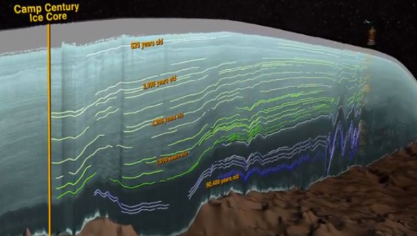
WATCH: NASA | Greenland’s Ice Layers Mapped in 3D, A Video published by NASA Goddard Space Flight Center
Excerpts
Scientists using ice-penetrating radar data collected by NASA’s Operation IceBridge and earlier airborne campaigns have built the first-ever comprehensive map of layers deep inside the Greenland Ice Sheet.


