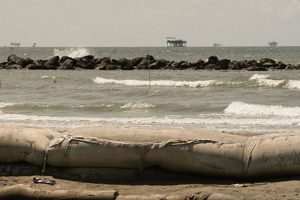

Sand Levee, Rock Levee, Ocean, Beach and Oil Rigs…Port Fourchon, Louisiana, Jefferson Parish. Photo source: © © New Orleans Lady
“Seventy percent of the Gulf of Mexico shoreline is vulnerable to extreme erosion during even the weakest hurricanes, according to a 2012 report by the U.S. Geological Survey. USGS
Excerpts;
Scientists, regional managers, coastal planners, businesses and residents of Louisiana can now use NOAA’s popular Sea Level Rise and Coastal Flooding Impacts Viewer to assess their risks for coastal flooding under a variety of different scenarios.
The Louisiana update expands the tool’s coverage to all coastal U.S. states and territories, except for Alaska where gaps in the underlying geospatial and mapping data remain.
The Sea Level Rise Viewer, featured on NOAA’s Digital Coast, is a powerful planning tool that lets users along the U.S. coast visualize and map the potential effects of sea level rise and coastal flooding. The viewer provides hypothetical coastal flooding scenarios with visualizations of local landmarks, uncertainty maps, marsh impact maps, and flooding frequency charts showing how sea level rise will affect the population and economy of heavily populated, ecologically important coastal areas…
Gulf Eats Away at Coast Outside Levee-Protected New Orleans, AP (09-14-2015)
In the past century, more than 1,880 square miles of Louisiana land has turned into open water — an area nearly the size of Delaware. And the loss continues unabated, with an estimated 17 square miles disappearing on average each year…
Lost Louisiana: The Race to Reclaim Vanished Land Back From The Sea, Guardian UK (10-15-2014)


