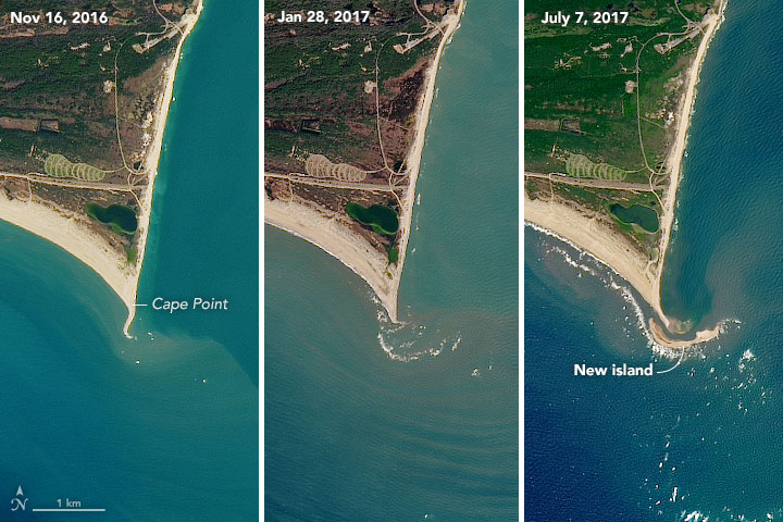

The waters off of North Carolina’s barrier islands have been called a “graveyard of the Atlantic.” Countless ships have wrecked here, due to the area’s treacherous weather and currents and its expansive shoals. These shoals are, by definition, usually submerged. But occasionally parts of them can rise above sea level.
These natural-color images, acquired by the Operational Land Imager (OLI) on the Landsat 8 satellite, show the shoal area off of Cape Point at Cape Hatteras National Seashore—the site of a newly exposed shoal nicknamed “Shelly Island.” The first image was captured in November 2016. When the second image was acquired in January 2017, waves were clearly breaking on the shallow region off the cape’s tip. The site of those breakers is where the island eventually formed, visible in the third image captured in July 2017. The new island measures about a mile long.
Captions and Image source: NASA / Earth Observatory
Excerpts;
Rough surf from Hurricane Irma brought more than just great waves to the popular Shelly Island sandbar. It also brought some dramatic changes to the long formation off of Cape Point…
Read Full Article, Outer Banks Voice (09-20-2017)
New Island Appears Off U.S. Coast; The National Geographic (06-27-2017)
It appeared out of nowhere in April just off North Carolina’s Outer Banks—a new land mass poking through the surf, a brand new Atlantic Ocean island. This new formation is of a scale rarely seen…


