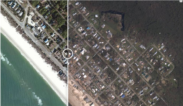
Before/after imagery of Beacon Hill, Florida. View NOAA aerial imagery collected to assist in damage assessment in the aftermath of Hurricane Michael. Captions and photo source: NOAA
Excerpts;
In the aftermath of Hurricane Michael, NOAA’s Office of Response and Restoration is reviewing early imagery to begin identifying potential pollution sources, such as displaced vessels and containers.
Hurricane Michael made landfall near Mexico Beach, Florida on October 10th, as a Category 4 storm with winds of 155 miles an hour. Water levels at NOAA’s tide gauge in Apalachicola, Florida, broke the 2005 record set by Hurricane Dennis with a recorded 7.72 feet above high tide. Though the full impact has not yet been evaluated, the hurricane-force winds and storm surge have caused significant damage and there have already been several reports of displaced, overturned, or capsized vessels…


