This Isn’t Your Grandparents’ Summer Heat – Scientific American

The face of summer is transforming, as people today face more frequent, longer-lasting and hotter heat waves than they did several decades ago…
Sand, Sea and as Much Serenity as You Could Ever Want – the New York Times

The bluffs, dunes and lagoons of the Magdalens, a colorful yet tranquil island chain north of Prince Edward Island, are far from everywhere. That’s the point…
Louisiana’s coast is sinking. Advocates say the governor is undermining efforts to save it – the Washington Times
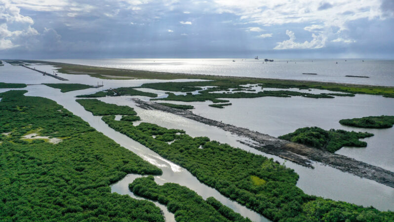
A new Republican governor is taking aim at the state’s coastal protection agency…
Ocean Wonders: Slumber in the Sea – Hakai Institute
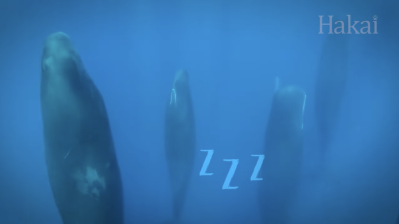
Though we’re still not sure exactly why we and other animals snooze, we do know that sleep can look very different for creatures living underwater. Follow us down into the deep to discover how dozing in the ocean can be more bizarre than your wildest dreams…
A Hidden Threat – the Washington Times
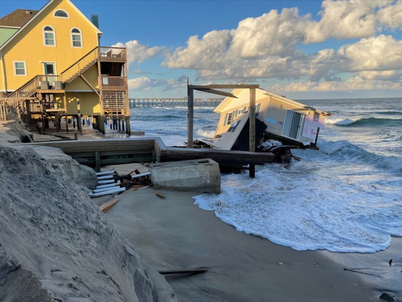
Fast-rising seas could swamp septic systems in parts of the South…
Emerging La Niña could play major role in this year’s hurricane season – the San Francisco Chronicle
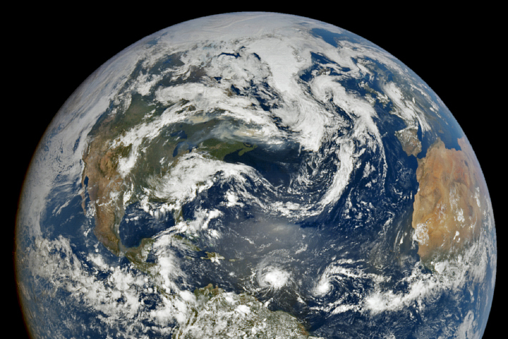
On Thursday, the National Oceanic Atmospheric Administration released its 2024 hurricane season outlook. The agency predicts an active season in the Atlantic hurricane region, with its most aggressive May forecast on record. The Atlantic hurricane region includes the north Atlantic Ocean, Caribbean Sea and Gulf of Mexico….
The ‘Doomsday Glacier’ is melting faster than scientists thought – Grist Magazine
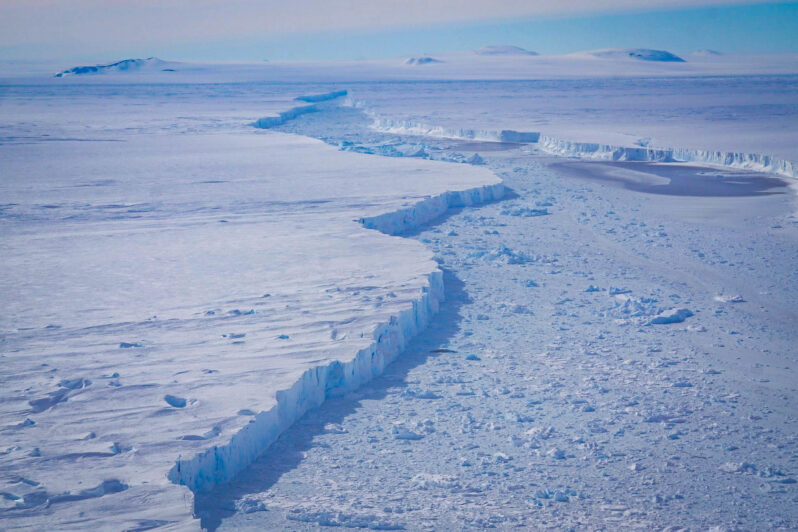
Miles of seawater are flowing under Thwaites Glacier, undermining an Antarctic ice sheet and threatening rapid sea level rise….
The surprising reasons thunderstorms are more destructive than ever – the Washington Post
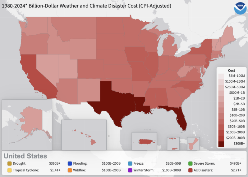
There were a record-setting 28 billion-dollar disasters last year, causing $94 billion in damage. Thunderstorm events accounted for 19 of those disasters, and more than half of the costs. A decade earlier, seven thunderstorm events topped $1 billion in damage…
In Two New Studies, Scientists See Signs of Fundamental Climate Shifts in Antarctica – Inside Climate News
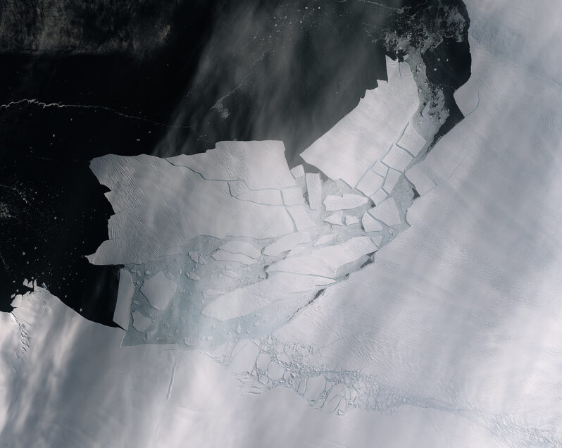
A steep decline of Antarctic sea ice may mark a long-term transformation in the Southern Ocean, and seawater intrusions beneath the Thwaites Glacier could explain its melting outpacing projections…