The climate change clues hidden in the work of Canaletto – Royal Museums Greenwich

Canaletto’s paintings of Venice portray an apparently timeless city. But look a little closer, and all is not as it seems..
For 150 years, tide gauges have recorded the sea level around the city of Venice. These careful, consistent measurements help Venetians understand the risk of flooding in their city, and are also used by scientists to predict how fast sea levels may rise in the future…
Mass storm outages bring misery across California, exposing power grid’s vulnerabilities – the Los AngelesTimes
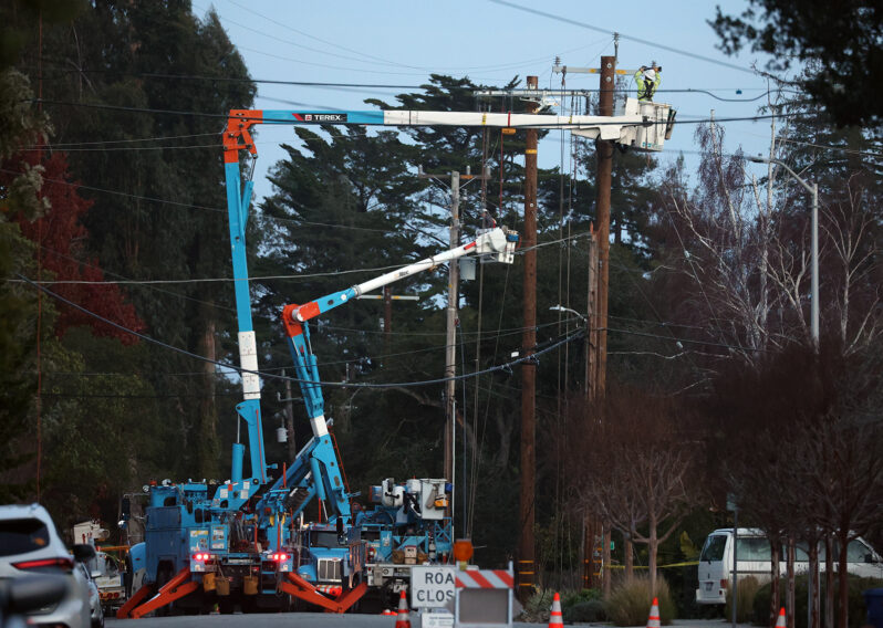
David Higares was on his fourth day without power in his Morada home in San Joaquin County when he woke up to indoor temperatures barely above 50 degrees.
His lights had flickered twice since his neighborhood outside Stockton went dark Saturday, following one of the train of atmospheric river storms, but his home remained dark, he said. Each time he checked, it seemed Pacific Gas & Electric had again pushed back the estimate for restoring power.
“It feels endless at this point,” said Higares, who lost all the food in his refrigerator and freezer due to spoilage. “Basically, we’re camping indoors.”
Since New Year’s Eve, hundreds of thousands of Californians have lost power — many multiple times…
24 trillion gallons of water have drenched California, and storms aren’t over – the Washington Post
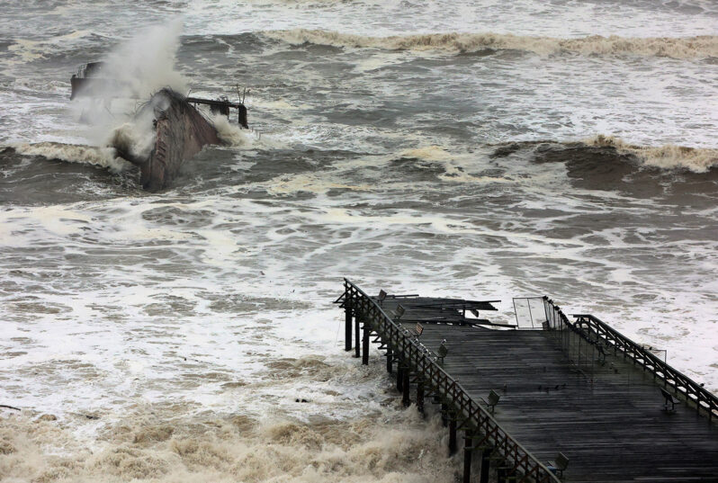
Since late December, California has seen it all. More than a foot of rain has come down in the lowlands, with eight feet of snow in the Sierra Nevada. For the state as a whole, the equivalent of about 24 trillion gallons of water has poured down from the sky — or an average of more than 8.5 inches of rain over every acre.
It’s not just water that has blasted the state. Winds nearing hurricane force have torn from the coast to the Central Valley and into the mountains, downing untold numbers of trees and cutting power to hundreds of thousands. A tornado danced south of Sacramento.
At least 18 people have died in the onslaught of storms, and it’s not over yet…
USGS Remote Sensing Data Tracks Coastal Erosion from California Storms – USGS
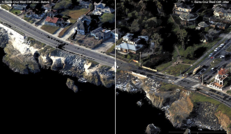
The USGS has collected and released topographic data that show the erosional effects of the January 2023 storms on the coast for the Santa Cruz region of California…Comparing the data with pre-storm conditions mapped in September 2022 provide “before” and “after” perspectives of the effects of the January storms. These data have been released under USGS Emergency Use Data authorities for data that have immediate or time-sensitive relevance to public health and safety…