Shoreline Erosion | Coastal Armoring + Engineering

March 10, 2024

San Pedro - Sunken City (by Indabelle CC BY-NC 2.0 DEED via Flickr).

Landslides are changing Calif.’s coastline. 100 years ago, one swallowed a city – SF Gate

Excerpt:
The ruins of a neighborhood destroyed by a landslide have drawn oglers for decades

Coastal landslides and shifting ground have made headlines recently around Los Angeles, particularly on the otherwise quiet Palos Verdes Peninsula at the southern tip of the county. The looming landmass juts out into the Pacific Ocean near Long Beach and is topped with rolling hillsides, dramatic ocean views and multimillion-dollar homes. 

The recent news is alarming — but not new. Nearly a century ago, a landslide in San Pedro swallowed up a huge chunk of an entire neighborhood. The shift destroyed homes built on the edge of a coastal bluff, issuing a warning to future homeowners in the region.

Nearly 100 years on, the concrete ruins of that devastation can still be experienced today.

It’s impossible to be a landowner on the Palos Verdes Peninsula today and not be worried about the uncertain future of the soil below.

In February, the historic (and Instagrammable) Wayfarers Chapel in Rancho Palos Verdes closed indefinitely following reports of a ground shift under the building, leaving happy couples that had landed a coveted wedding date at the venue scrambling to change plans. Trails in the Portuguese Bend Preserve, a popular hiking area offering sweeping views of the Pacific Ocean, are also mostly closed due to potentially hazardous conditions, including “active landslide area, land movement, sink hotels, unstable trails and surfaces, erosion, steep cliffs, and falling rocks.” The city of Rancho Palos Verdes has even called for a state of emergency declaration after recent rains accelerated land movement, threatening dozens of homes. 

While land movement has accelerated on the peninsula in recent years, it’s not a new phenomenon for the Southern California coastline. Since development first began in the region, Californians enthralled with ocean views have wanted to live as close to the coast as possible. Sometimes that means putting up with an increased risk of landslides.

Back in the 1920s, residential and commercial development began in the Point Fermin area of San Pedro, a neighborhood on the peninsula. Homes were constructed atop a coastal cliff along the newly built Paseo Del Mar, offering pristine views of the ocean and Catalina Island. But in 1929, those homes began sliding down toward the ocean.

A landslide in the area caused the abandonment of about 14 homes along Paseo Del Mar. In the years since, an estimated 120 feet of horizontal movement and up to 50 feet of vertical movement have occurred, leaving a jagged coastline that is always in flux.

The resulting destruction is still on view today. Locals and tourists alike flock (illicitly) to “Sunken City,” where large blocks of graffiti-covered concrete pile up along the shore below Paseo Del Mar, the end of which suddenly drops off the side of a cliff. 

Since the immediate aftermath of the 1929 landslide, people have gathered at the site to ogle the example of natural forces besting development, to party or just to stare out into the ocean. In 1932, with Los Angeles hosting the Olympics, a local plumber tried to capitalize on the landslide, offering Olympic visitors the chance to “prowl about the phenomenon, listen to its tragic history, inspect graphs and even take the temperature of one fissure where the tepid air is emitted…”

More on Shoreline Erosion | Coastal Armoring + Engineering . . .
Sea wall drains, Prachuap Bay, Prachuap Khiri Khan, Thailand (by Troup Dresser CC BY-NC 2.0 DEED via Flickr).

Can Seawalls Save Us? – the New Yorker

Pacifica, California, just south of San Francisco, is the kind of beachfront community that longtime residents compare to Heaven…Pacifica embodies one of the central disagreements about rising seas. Fight or flight? Stay or go? Flight can seem unimaginable. But, if we try to fight the ocean with rock and concrete, it will cost us—and it may not work…

Seven Mile Beach, Cayman Islands (by Brook Ward CC BY-NC 2.0 DEED via Flickr).

Erosion Stripping Seven Mile Beach – cayman compass

The Compass recently observed the length of the beach using a drone camera to get the most up-to-date images of the impacts of the storm and ongoing erosion. It showed that some areas along the southern stretch have suffered a total loss of beach, and in at least one section, a near-5-feet-high ledge of sand has been created by the bombardment of the waves…

Ground level rendering of proposed pump station and expanded flood wall along the Elizabeth River (courtesy of US Army Corps of Engineers | City of Norfolk, via ResilientNorfolk.com)

At risk from rising seas, Norfolk, Virginia, plans massive, controversial floodwall – NPR

The city (of Norfolk) is now moving forward with a massive floodwall project to protect itself, in partnership with the U.S. Army Corps of Engineers. The project will include tide gates, levees, pump stations and nature-based features like oyster reefs and vegetation along the shoreline. It’s one of the biggest infrastructure efforts in city history – and an example of projects the Corps has proposed up and down the U.S. coastline, from New York to Texas….

Groundsel Tree (Baccharis halimifolia) Swindler Cove, Inwood Hill Park, New York City (by Steve Guttman CC BY-NC-ND 2.0 via Flickr).

Northern Manhattan Wetland Faced with Climate-Change-Induced Erosion is Reimagined – Inside Climate News

When the New York Restoration Project first started working in the late 1990s to clean the unnamed shoreline along the Harlem River in northern Manhattan, the intertidal mudflat and wetlands weren’t just a neglected area, but a former illegal dumping ground. How the cove, the largest wetland left in Manhattan, has become a bountiful greenspace where migrating birds, crabs, tadpoles and toads are all thriving, despite the existential threat posed by climate change in shoreline communities, is a story of robust community involvement and skillful coastline management…

Kalaloch Lodge, on the west coast of Washington's Olympic Peninsula (by Ron Sipherd CC BY-NC-ND 2.0 via Flickr).

Slipping away: Erosion forces Olympic National Park to take a hard look at Kalaloch Lodge – the Seattle Times

Kalaloch is the third-most-visited of Olympic National Park’s nine districts…Kalaloch Lodge, run on a concessionaire’s contract by the global entertainment/hospitality company Delaware North…has grown into a beachfront hotel with a restaurant overlooking the ocean, a small grocery store, a campground and nearly 50 cabins sitting on the same bluffs where the Beckers built their rustic resort 95 years ago. Except there’s less bluff. And less of it every year….

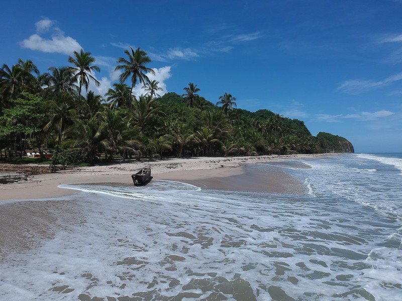
Fishing boat on the beach in Sri Lanka (by Goran tek-en, CC BY-SA 4.0 via Wikimedia).

AP Photos In Sri Lanka, Fishers Suffer as Sea Erosion Destroys Homes and Beaches – AP

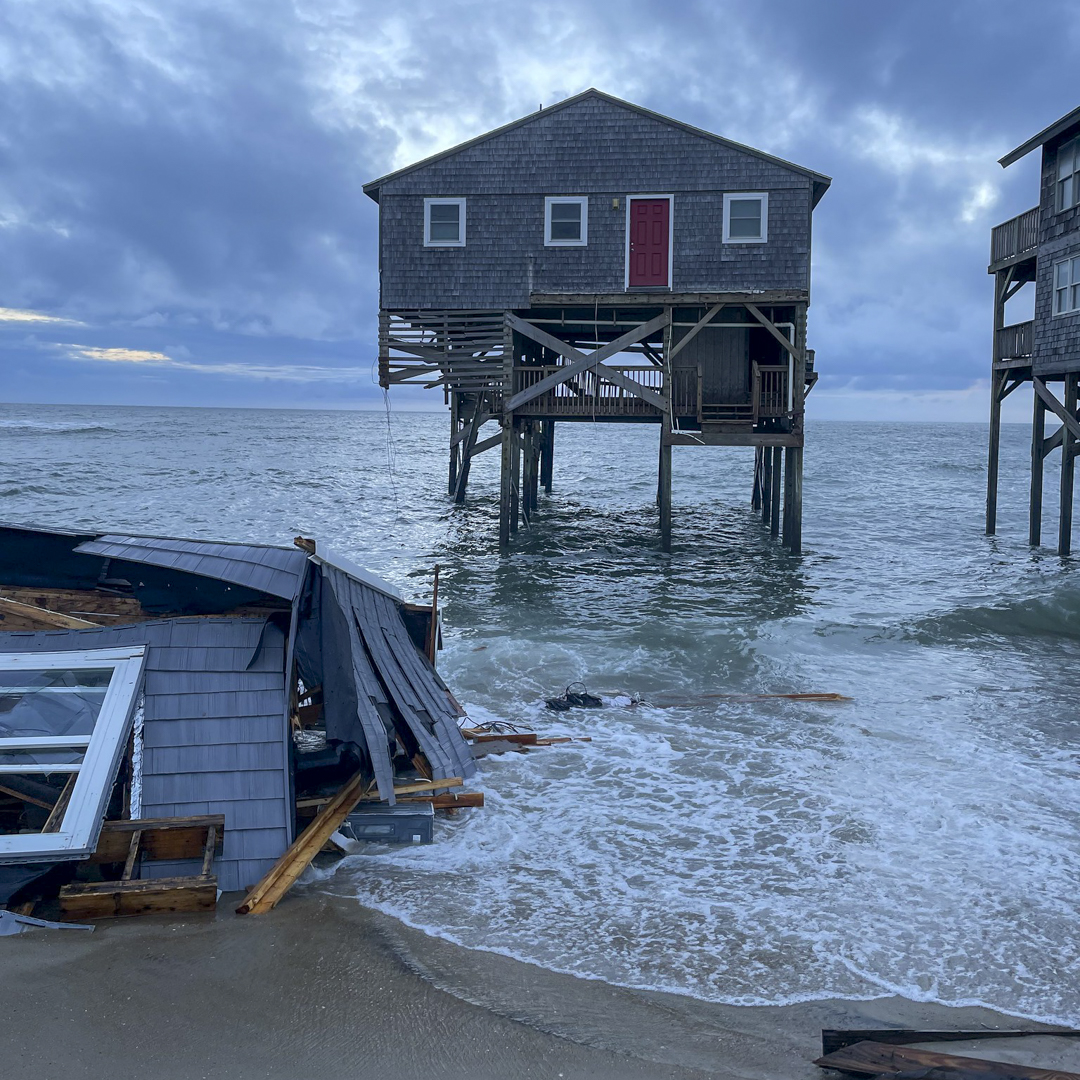
Ranjith Sunimal Fernando now has a shell of a home at the edge of Sri Lanka’s coast, lost to the sea. Waves lap past the broken walls into damaged, empty rooms.

“One night last month, my son went to the bathroom and I suddenly heard him screaming, ‘our house has gone into the sea!’,” said Fernando, a 58-year-old fisher born and raised in Iranawila, about 80 kilometers (50 miles) north of the capital, Colombo…

no more posts . . .