Before the flood: how much longer will the Thames Barrier protect London? – the Guardian
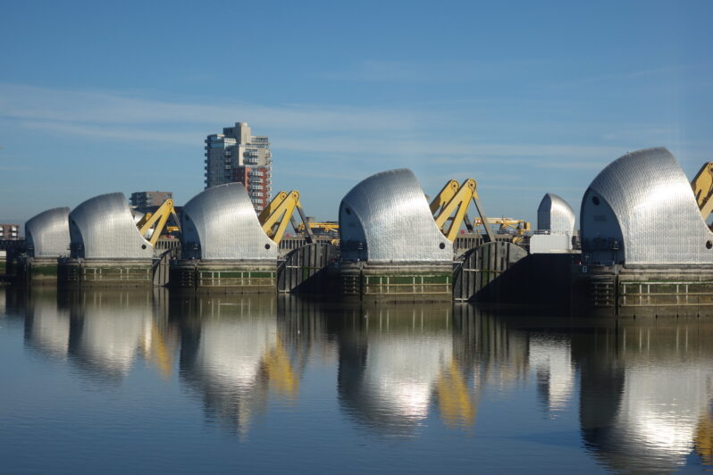
The last time the Thames broke its banks and flooded central London was on 7 January 1928, when a storm sent record water levels up the tidal river, from Greenwich and Woolwich in the east as far as Hammersmith in the west. Built on flood plains, the capital was defended only by embankments. The flood waters burst over them into Whitehall and Westminster, and rushed through crowded slums. Fourteen died and thousands were left homeless…
How First Nations Are Asserting Sovereignty Over Their Lands and Waters – the Tyee
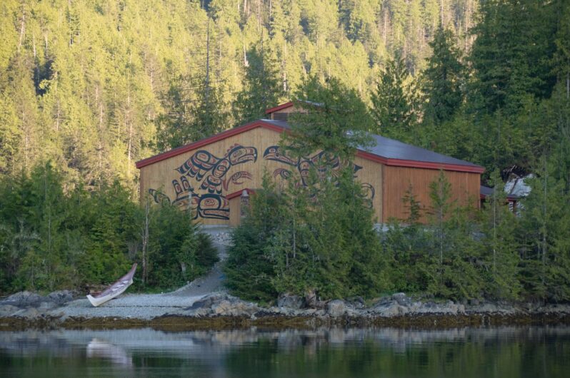
Indigenous Marine Protected and Conserved Areas hold a key to food security and balancing ecological and economic priorities. Part one of two.
Kitasu Bay sits within the traditional territory of the Kitasoo Xai’xais First Nation and is located on the Central Coast of British Columbia. Last summer the nation declared it a protected area under their own laws, closing it to commercial harvest by non-Indigenous fishers. Their declaration invited the provincial and federal governments to work with them to develop a co-governance model, but added, “we seek no permission…”
At last, Venice’s authorities admit the risk from sea-level rise – The Art Newspaper
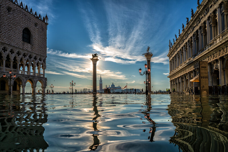
At a conference organised by the new Venice Sustainability Foundation in June, major public figures agreed for the first time that sea-level rise is the main problem facing the city now…