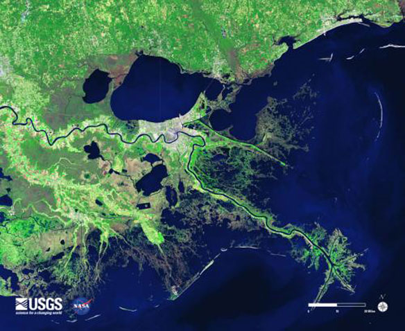
A satellite image of the lower Mississippi River (winding dark line) shows that south of New Orleans (white, at center) the wetlands (green) are severely tattered, allowing hurricanes and other storms to push surges of water from the surrounding Gulf of Mexico right into the city, largely unimpeded. Image source: USGS – NASA.
Excerpts;
Extensive studies done after Katrina verified what lifelong residents of southeastern Louisiana already knew: Unless the rapidly disappearing wetlands are made healthy again, restoring the natural defense, New Orleans will soon lay naked against the sea…
Read Full Article, Scientific American
The Next Big One, The Washington Post
Gulf Eats Away at Coast Outside Levee-Protected New Orleans, AP (08-14-2015)
Lost Louisiana: The Race to Reclaim Vanished Land Back From The Sea, Guardian UK (10-15-2014)
Louisiana has lost nearly 1,900 square miles of land over the past 80 years – a disappearing act that claims on average a football field an hour. Now, World’s fastest submerging state is looking to nature in an ambitious plan to turn back the tide…


