Excerpt:
Shortly after dawn on Sept. 30, 2021, Richard Jenkins watched a Category 4 hurricane overrun his life’s work. The North Atlantic storm was a behemoth — 50,000 feet tall and 260 miles wide. Wind circled the eye wall at 143 miles per hour; waves the size of nine-story apartment buildings tumbled through a confused sea. Puerto Rico lay 500 miles to the southwest; Bermuda was 800 miles straight ahead. Eighty miles northwest, the 23-foot boat that Jenkins had designed and built over the last decade struggled to stay upright.
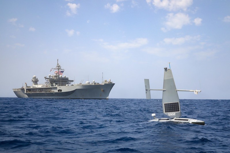
Saildrone Explorer SD 1045 was a research boat. Its blaze-orange torpedo-shaped hull had a deep keel and a rigid carbon-fiber sail engineered to withstand hurricane-force wind and waves. Probes, antennae and a suite of meteorological and oceanographic instruments jutted from the deck and the hull, all powered by wind, water and sun and capable of measuring the extraordinary forces of the open ocean…
The ocean is a terrestrial outer space — Earth’s last true wilderness, which remains surprisingly unexplored by humankind…NOAA oceanographer Adrienne Sutton, argued that this “black hole of data” is hampering our understanding of how the ocean is changing and how those changes affect food webs, carbon sequestration, weather and storms. To date, the world’s oceans have taken in around 90 percent of the heat trapped by greenhouse gases and more than 30 percent of carbon dioxide emitted by human activity. This role as buffer, which has most likely saved humanity from certain and swift extinction, has come with consequences, including sea-level rise, ocean acidification, coral die-offs, shifting global circulation currents and a rise in intense tropical cyclones…
As another hurricane season approaches, much of the U.S. coast remains unprepared. Flood insurance for millions of Americans living near the ocean is still optional. Some federal disaster loans to rebuild after a storm are contingent on credit; consumer-protection laws do not rein in corrupt contractors who flock to disaster areas; and many state governments lack the funds and staffing necessary to manage recovery…
What worries tropical-cyclone modelers like Hiro Murakami, a project scientist at NOAA’s Geophysical Fluid Dynamics Laboratory in Princeton, N.J., are regions with little to no experience with major storms being drawn into tropical-cyclone territory. Warming water off the coast of Europe over the last 20 years has opened the door to storms like ex-Hurricane Ophelia in 2017, which grazed Ireland with gusts up to 119 m.p.h. The next year, Hurricane Helene followed a rare path, traveling north from Africa, instead of west, eventually affecting the United Kingdom. Other regions being drawn into cyclone territory include India’s west coast, eastern Japan, Hawaii and the sprawling agrarian-industrial coastline that wraps around northeastern China.
Storms are even hitting the Middle East with more power, Murakami says, like Cyclone Shaheen in 2021. The storm took a remarkable path from the Bay of Bengal across India and the Arabian Sea and made landfall in Oman as a severe cyclone, the first one there in recorded history. “They have no experience with it,” Murakami says. “No dikes. No defenses…”


