Excerpt:
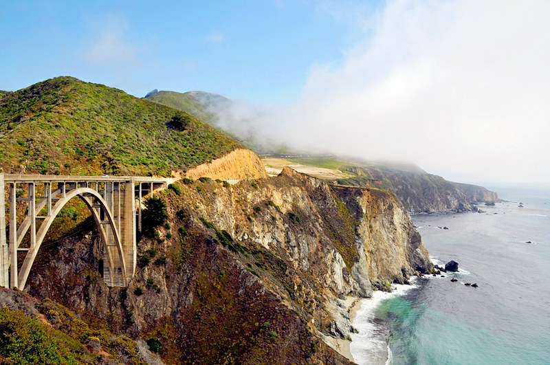
A stretch of Highway 1 in Big Sur is closed indefinitely after the southbound lane eroded during last weekend’s rainstorm, bringing uncertainty to the communities that rely on the road for transportation.
A stretch of Highway 1 in Big Sur is closed indefinitely after the southbound lane eroded during last weekend’s rainstorm, bringing uncertainty to the communities that rely on the road for transportation.
As Caltrans works to repair the road, which is closed from Limekiln State Park to Palo Colorado in Monterey County, the agency is coordinating convoys for residents and essential workers to enter and exit the area for food and supplies. The state is now working on a temporary fix that would allow residents and visitors to pass using the structurally stable northbound lane of traffic.
It’s one of several closures along this stretch of Highway 1 in recent years, as slides during the rainy season wash rocks down.
That’s because the area’s mountainous terrain and steep cliffs — the very thing that makes the area a world-famous road trip destination — are what makes the road so prone to rapid erosion, or slip-outs.
How geology explains the slip-outs
It might not have crossed your mind when you’re driving on that part of Highway 1, but the road was built on highly unstable ground, full of faults and fractures in the ground that leave the area prone to rockslides, especially after heavy rainfall.
In short, the Big Sur coastline is “a road builder’s nightmare,” said Dick Norris, marine geologist at University of California San Diego’s Scripps Institution of Oceanography.
According to Norris, much of Highway 1 was built downhill from the location of previous rockslides — and once a slide has happened, it’s more likely to recur.
“I think that probably many of the current slides are old slides that are being reactivated,” Norris said. “Then of course, the material that the roadbed is built on is oftentimes an old slide deposit…”

