Excerpt:
Geologists are working with local communities to determine how residents can adapt as the area’s sea level, in effect, goes down
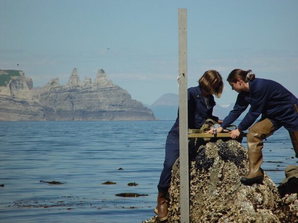
For the past four summers, a research team from Columbia University’s Lamont-Doherty Earth Observatory has loaded into a small plane and flown to the town of Aasiaat, on an island of the same name off the western coast of Greenland. The researchers are venturing to the Aasiaat Archipelago as part of a project to study how sea levels may change across the area in the ensuing decades. Their findings—which are revealing shifts different from what most of the world is experiencing with sea-level rise—will help local communities that depend on these waters for travel and sustenance.
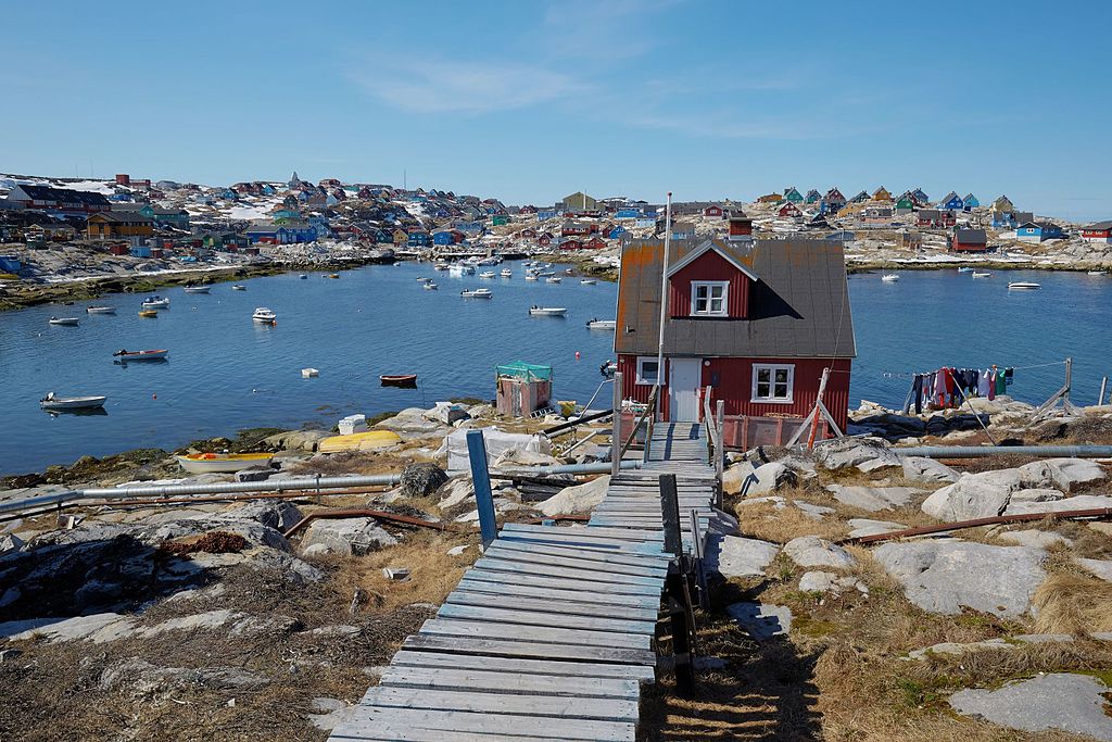
Aasiaat is an industrial town rooted in aquaculture that sits roughly 25 miles from the coastline where the Greenland ice sheet meets the sea. Small houses of vibrant colors date back to the colonial era, when buildings were color-coded according to function: red for commercial buildings, yellow for hospitals and blue for fish factories. The buildings contrast greatly with the surrounding icy terrain. In the long winter months, snow blankets the ground here. In the summers, gray metamorphic rock is exposed along the coast, and fishing boats line the harbors.
Vessels come and go throughout the day according to the tides. The shallow water’s high concentration of nutrients—which result from the mixing of colder saltwater with freshwater from glacial melt—supports the growth of plankton. The marine drifters form the base of an intricate food web and attract an abundance of fish, seals, whales and seabirds.
The numerous islands and sheltered bays within the Aasiaat Archipelago also provide ideal breeding grounds for many marine mammals and seabirds, which the scientists will see often as they do their work. Seals and walruses use the shallow waters for hunting and raising their young. Seabirds like puffins, fulmars and guillemots nest on the rocky cliffs of the islands. As the world warms and sea levels change, these animals will have to adapt, but so too will the residents of towns like Aasiaat. The work of the Columbia researchers will inform the community as they decide how to do just that.
Around the globe, seas are rising. Since 1880, global average sea level has risen nine inches or so. Even if we are able to significantly reduce greenhouse gas emissions around the world, researchers estimate that the sea level around the United States will be two feet higher in the year 2100 than it was in 2000. Yet, amid this rising swell, Greenland offers a stark contrast. The land, rather than the sea, is rising.
“From a U.S. focus, what we’re mostly worried about is flooding and sea levels rising and damage from things like that,” says project researcher Kirsty Tinto, a geophysicist at Lamont-Doherty Earth Observatory. “Here, we’re talking about sea-level fall in a super marine-based culture.”
As the ice that covers Greenland melts, land freed from its weight gradually rises in a process known by scientists as isostatic rebound. The pressure that once compressed the Earth’s crust eases, and Greenland and its collection of coastal islands rises by millimeters each year.
In addition to this upward movement, the melting ice affects the surrounding ocean. Ice sheets exert a gravitational pull on nearby water, drawing the sea toward the ice mass. As the ice melts, this pull weakens, and the water redistributes around the globe. This redistribution can cause local sea levels near Greenland to drop slightly, while raising sea levels in more distant regions.
“The net effect of ice sheet melt is going to be a shallowing of the sea level rather than the sea-level rise that you get in the rest of the world,” says Tinto, “and that was where we had different questions coming in and touching each other.”
Tinto and her team set out to determine how the coastline of Greenland would change as the sea level goes down. The National Science Foundation-funded project looks at four Greenlandic shallow-water communities—Kullorsuaq, Nuuk, Tasiilaq and Aasiaat. Over the ensuing years, the researchers aim to study the bathymetry—or ocean floor—of the surrounding waters. They want to provide the local community with a clearer picture of the emerging seascape and how it will impact their lives.
“We can say the sea level is going to drop between one and three meters in Greenland by the year 2100, but what does that mean for a person who lives on the coast if you don’t have the bathymetry mapped to accuracy?” says Tinto. “What difference does it really make..?”

