How Terrestrial Turds Lead to Marine Maladies – Hakai Magazine
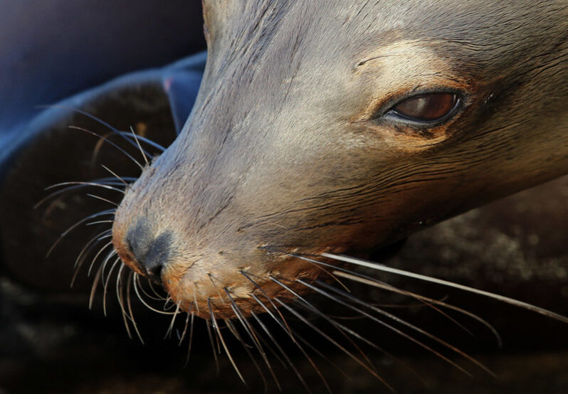
Diseases from land animals are killing marine mammals at an alarming rate. Can we stem the flow of feces?
We Traced the Forever Chemicals Getting Into Ocean Ecosystems – the Conversation

PFAS, the “forever chemicals” that have been raising health concerns across the country, are not just a problem in drinking water. As these chemicals leach out of failing septic systems and landfills and wash off airport runways and farm fields, they can end up in streams that ultimately discharge into ocean ecosystems where fish, dolphins, manatees, sharks and other marine species live…
Oil spill tops 1 million gallons, threatens Gulf of Mexico wildlife – the Washington Post
Skimming vessels are working to contain and recover oil from a spill in the Gulf of Mexico off the Louisiana coast, which the U.S. Coast Guard on Tuesday estimated to be at least 1.1 million gallons. The spill was discovered Thursday near a 67-mile pipeline operated by the Main Pass Oil Gathering Co., owned by Houston-based Third Coast Infrastructure, and the Coast Guard said it was still reviewing whether that pipeline was the source of the contamination…
Groundwater a significant source of pollution on Great Barrier Reef, study shows – the Guardian
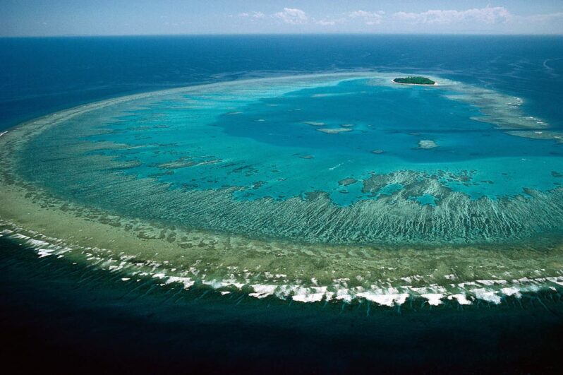
Scientists say they have discovered large flows of pollution are reaching the Great Barrier Reef after soaking into underground water, a finding that could have implications for policymakers focused on cutting pollution from river catchments. The new research claims almost a third of dissolved inorganic nitrogen and two-thirds of dissolved inorganic phosphorus in the reef’s waters are coming from underground sources – an amount previously undocumented…
Road Hazard: Evidence Mounts on Toxic Pollution from Tires – Yale Environment 360
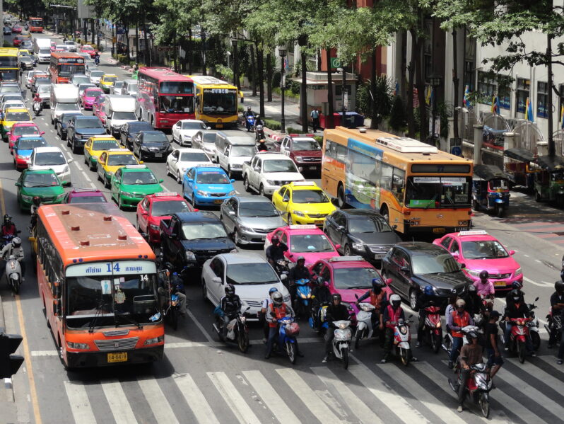
Researchers are only beginning to uncover the toxic cocktail of chemicals, microplastics, and heavy metals hidden in car and truck tires. But experts say these tire emissions are a significant source of air and water pollution and may be affecting humans as well as wildlife…
The race to defuse an oil ‘time bomb’ disaster threatening the Red Sea – Grist Magazine
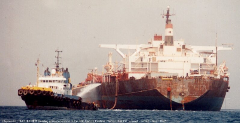
Ten days ago, the crew of a ship called the Nautica lifted anchor in Djibouti and motored north in the Red Sea. Two tugboats met the vessel about five and a half miles off the coast of Yemen, then guided it into place alongside the FSO Safer, a crumbling, abandoned oil tanker thought to hold 1 million barrels of crude.
Thus began an operation that’s the ecological equivalent of placing the pin back into a hand grenade…
Is Fukushima wastewater release safe? What the science says – Nature
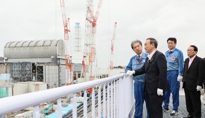
Despite concerns from several nations and international groups, Japan is pressing ahead with plans to release water contaminated by the 2011 meltdown of the Fukushima Daiichi nuclear power plant into the Pacific Ocean. Starting sometime this year and continuing for the next 30 years, Japan will slowly release treated water stored in tanks at the site into the ocean through a pipeline extending one kilometre from the coast. But just how safe is the water to the marine environment and humans across the Pacific region?
The Bay Area faces an imminent threat from sea level rise — but it’s different from what you think – San Francisco Chronicle
Dangerous chemicals hiding in the ground around the Bay Area are due to be released by groundwater as it’s pushed closer to the surface with sea level rise, a new study has found. In many cases, it can happen without warning as cancer-causing volatile compounds escape into schools and homes, experts say…
“Groundwater rise and sea level rise are gradual processes that are accelerating,” said Kristina Hill, associate professor at UC Berkeley’s College of Environmental Design, lead author of the study. “It’s a problem tomorrow, and it’s a problem today…”
A lifetime of research links Gulf of Mexico ‘dead zone’ to Midwest fertilizer runoff – Columbia Missourian

In the summer of 1985, Nancy Rabalais set sail on a research vessel into the Gulf of Mexico — and into the scientific unknown.Back then, scientists knew little about wide expanses of low-oxygen water, called hypoxia…That summer, Rabalais’ team was set on discovering how these areas connected to creatures that dwell on the bottom of the Gulf. While analyzing water and sediment samples miles off the coast, the team from the Louisiana Universities Marine Consortium and Louisiana State University quickly discovered that hypoxia stretched from the Mississippi River to Texas — and that it lasted for most of the summer…