The plan to make climate science harder to erase – Grist
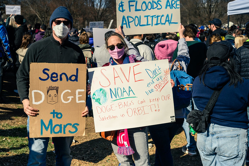
As climate information disappears from federal websites, scientists are rebuilding it elsewhere…
The Pacific Ocean is running a fever. Why that’s an ominous sign – the Washington Post
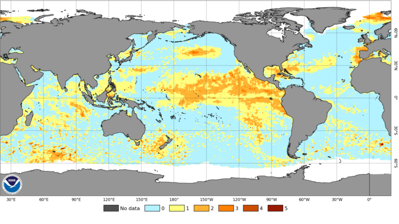
A marine heat wave covering an area eight times the size of the United States could soon fuel serious storms and extreme heat..
The global sand crisis: it’s being used up faster than it can be replaced – the Guardian
It is the most extracted solid material on Earth – but this extraction can threaten ecosystems and livelihoods…
High levels of toxic ‘forever chemicals’ found off coast of southern England – the Guardian
Study of Channel finds levels of toxic Pfas in Solent at 13 times safe limits in some places, with much coming from treated sewage..
Upcoming Launch: 3rd Sand and Sustainability report – UNEP | Grid-Geneva
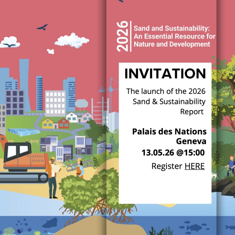
UNEP/GRID-Geneva is proud to announce the launch of the 3rd Sand and Sustainability report, which will take place on May 13th 2026 3pm at the UN Palais des Nations in Geneva.
Traditional protection proves more successful for clams in American Samoa – Mongabay
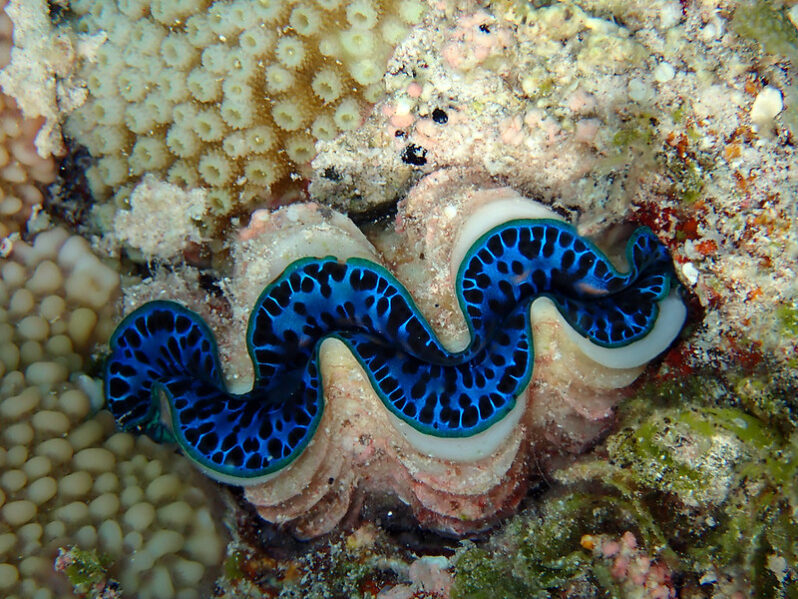
For coastal Indigenous communities in American Samoa, giant clams are deeply rooted in fa‘a Sāmoa (the Samoan way of life) and local food systems…According to the findings of a study published in PeerJ, it is village-based protections like fa‘asao (fishery closures) that have helped conserve giant clams lying in the islands’ shallow water coral reefs. The authors found that the highest clam densities and species are located in remote sites and areas under traditional village enforcement, outperforming federally designated no-take zones on the most populated island….
Delays & Reforms Raise Questions for Outer Banks Nourishment Efforts – Island Free Press
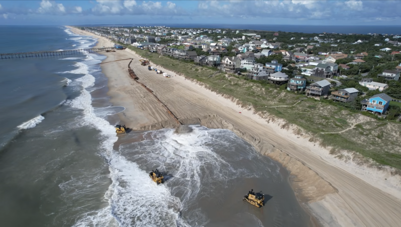
At the center of the uncertainty for upcoming beach nourishment projects is the Federal Emergency Management Agency — better known as FEMA — where policy changes, funding delays, and broader federal debates about disaster response are creating unknowns for coastal communities nationwide, including those on the Outer Banks…
World’s largest coral colony discovered off Australian coast by mother-daughter team – CNN Science

A mother-and-daughter team of citizen scientists has identified the world’s largest known coral colony, found on the Great Barrier Reef off the coast of Australia…
Italy’s famous ‘Lovers’ Arch’ collapses on Valentine’s Day – CNN Travel

An Italian coastal beauty spot known as “Lovers’ Arch” because of its popularity with courting couples collapsed during heavy storms on Valentine’s Day in what one local official called “a blow to the heart…”