Daniel Coe’s Astonishing River Cartography – Orion
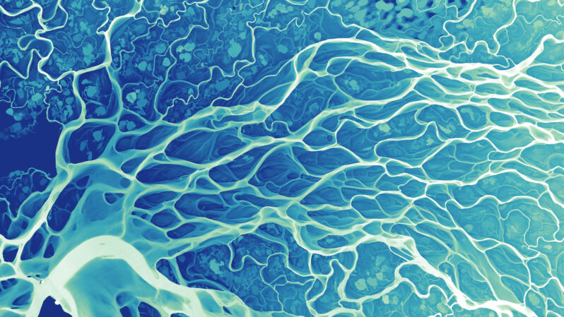
Cartographer Daniel Coe uses relative elevation data, primarily from plane-mounted lasers called lidar…His stunning river maps reveal stories hidden in historical sediment and past channels carved by the water, as it twists and turns through both landscape and time.