Seeing Through Turbulence to Track Oil Spills in the Ocean – EOS Magazine
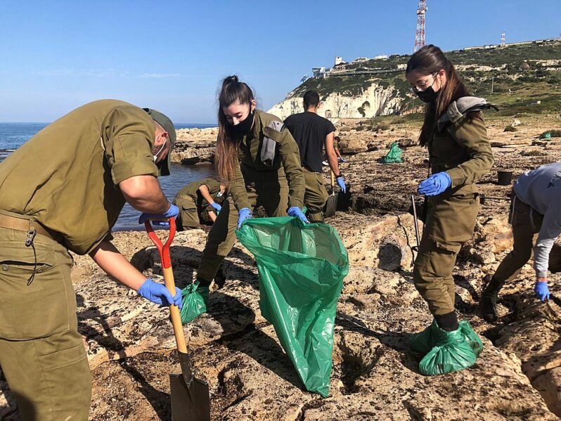
In mid-February 2021, heavy storms brought intense downpours to the eastern Mediterranean coast, keeping residents indoors. After the storms passed, residents returned to local beaches and noticed signs that something amiss had occurred offshore. In Israel, clumps of tarred sand appeared on beaches, along with oil-covered wildlife like turtles and fish. A dead 17-meter-long fin whale also washed ashore—an autopsy revealed oily liquid in its lungs, although the source of the oil was not identified definitively…
USGS Remote Sensing Data Tracks Coastal Erosion from California Storms – USGS
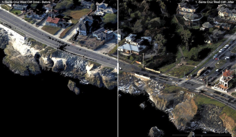
The USGS has collected and released topographic data that show the erosional effects of the January 2023 storms on the coast for the Santa Cruz region of California…Comparing the data with pre-storm conditions mapped in September 2022 provide “before” and “after” perspectives of the effects of the January storms. These data have been released under USGS Emergency Use Data authorities for data that have immediate or time-sensitive relevance to public health and safety…