
The extent of inundation from the destructive and deadly tsunami triggered by the March 11, 2011, magnitude 8.9 earthquake centered off Japan’s northeastern coast about 130 kilometers (82 miles) east of the city of Sendai is revealed in this before-and-after image pair from the Multi-angle Imaging SpectroRadiometer (MISR) instrument on NASA’s Terra spacecraft. Image Source: NASA/GSFC/LaRC/JPL, MISR Team
Excerpts;
Aerial photos taken over Japan have revealed the scale of devastation across dozens of suburbs and tens of thousands of homes and businesses…
Read Full Article, The New York Times
Google Satellite Images
The images, from Google partner GeoEye, were generated by the IKONOS satellite,. View slideshow in Los Angeles Times
Japan Tsunami, Before & After: Zoomable Satellite Images, National Geographic
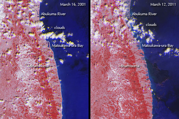
NASA Images Tsunami’s Effects on Northeastern Japan, NASA / JPL


