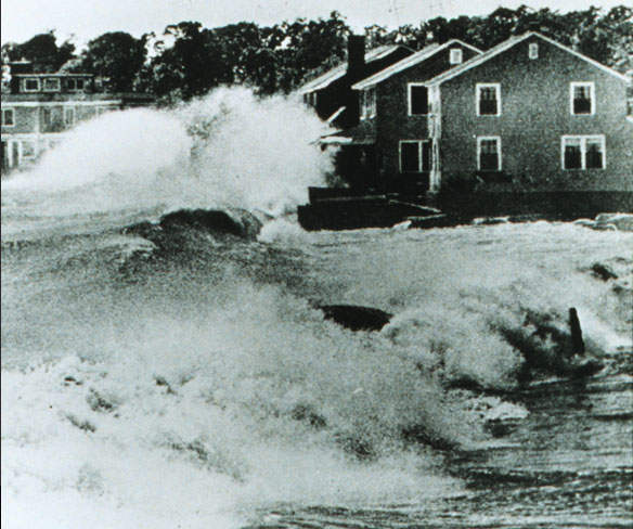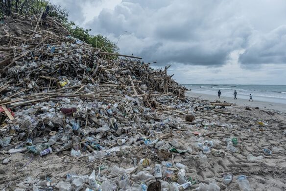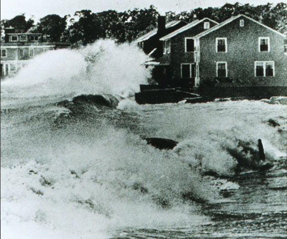
Hurricane Carol striking US east coast, destroyed hundreds of summer cottages and homes Huge waves bound into beach front homes, 1954. Hurricane Carol was among the worst tropical cyclones to affect the New England region of the United States. It developed from a tropical wave near the Bahamas on August 25, 1954, and slowly strengthened as it moved northwestward. Captions and Photo source: American Red Cross / NOAA
By USGS;
Nearly three quarters of the coast along the Delmarva Peninsula is very likely to experience beach and dune erosion as Hurricane Sandy makes landfall, while overwash is expected along nearly half of the shoreline.
The predictions of coastal change for the Delaware, Maryland and Virginia peninsula is part of a larger assessment of probable coastal change released by the U.S. Geological Survey Friday.
“Model forecasts are run anew for each hurricane, as each case has unique factors in terms of storm intensity, timing with respect to tides, angle of approach, and must account for ever-changing details of coastal dune configuration,” said USGS Director Marcia McNutt. “These models help us understand where emergency management resources might be most needed.”
Overwash, the landward movement of large volumes of sand from overtopped dunes, is forecasted for portions of the east coast with the projected landfall of the storm. The severity of overwash depends on the strength of the storm, the height of the dunes, and how direct a hit the coast takes.
“On the Delmarva Peninsula, near the storm’s expected landfall, close to three quarters of the sandy coast is expected to see beach and dune erosion. Fifteen percent of the coast is very likely to be inundated by waves and storm surge,” said USGS Oceanographer Hilary Stockdon from the USGS St. Petersburg Coastal and Marine Science Center.
In these areas, waves and storm surge would transport large amounts of sand across coastal environments, depositing sand both inland and offshore and causing significant changes to the landscape, Stockdon noted.
The models show that along the New Jersey shore, 81 percent of the coast is very likely to experience beach and dune erosion, while 7 percent is very likely to experience overwash. It also indicates that on the south shore of Long Island, N.Y., including Fire Island National Seashore, 43 percent of the coast is very likely to experience beach and dune erosion. Overwash and inundation are not expected in these areas because of the relative high dune elevations.
According to USGS geologist Cheryl Hapke, many of the sandy beaches along the mid-Atlantic Coast have become increasingly vulnerable to significant impacts such as erosion because of past storms, including Hurricanes Ida (2009) and Irene (2011), as well as large northeastern storms in 2005 and 2007.
“Beaches and dunes often serve as the first line of defense for coastal communities against flooding and other hazards associated with extreme storm” said Hapke, “Any compromise to these features means that storm-related hazards are more likely to threaten coastal property, infrastructure, and public safety during a future extreme storm event.”
Beach and dune erosion occurs when storm surge and waves collide with the base of a dune, termed collision in the model, and wash away significant amounts of sand. Overwash happens when these forces exceed dune height and move sand inland. Inundation is a process by which an entire beach system is submerged and, in extreme cases, can result in island breaching.
Storm-Surge Sensors Deployed Ahead of Tropical Storm Sandy
Storm response crews from the U.S. Geological Survey are installing more than 150 storm-tide sensors at key locations along the Atlantic Coast,from the Chesapeake Bay to Massachusetts, in advance of the arrival of Tropical Storm Sandy.

