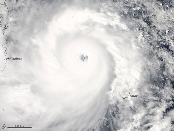
The Moderate Resolution Imaging Spectroradiometer (MODIS) on NASA’s Aqua satellite acquired this natural color image of Super Typhoon Haiyan as it approached the east coast of the Philippines. The image was acquired at 1:25 p.m. local time (4:25 Universal Time) on November 7, 2013. Captions and image source: Earth Observatory, NASA
Excerpts;
Super Typhoon Haiyan, which is one of the strongest storms in world history based on maximum windspeed, is about to plow through the Central Philippines, producing a potentially deadly storm surge and dumping heavy rainfall that could cause widespread flooding.
The densely populated city of Manila, home to 12 million, is in the storm’s path, although it is predicted to escape the worst of the winds and storm surge…
Read Full Article, Climate Central
Super Typhoon Haiyan, one of strongest storms ever, heads for central Philippines, CNN
With sustained winds of 315 kph (195 mph) and gusts as strong as 380 kph (235 mph), Super Typhoon Haiyan was churning across the Western Pacific toward the central Philippines. Its wind strength makes it equivalent to an exceptionally strong Category 5 hurricane…


