Astronaut photograph ISS052-E-6364 was acquired on June 21, 2017.

Astronaut photograph ISS052-E-6364 was acquired on June 21, 2017.
By Justin Wilkinson, NASA / Earth Observatory,
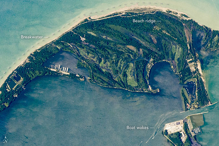
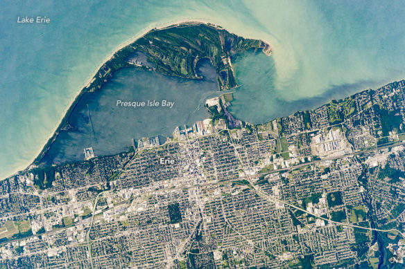
An astronaut aboard the International Space Station focused a long-lens camera on the southern coastline of Lake Erie. The curved peninsula of Presque Isle State Park juts into the Great Lake, while the city in the lower part of the image is the deep-water port of Erie, Pennsylvania. Several V-shaped wakes show boat traffic around the port.
The lake water just offshore tends to be light-toned because significant river and beach sediment is regularly moved eastward by the action of wind and waves. The detailed image shows the swells made by these winds.
Sediment has piled up to build this sand spit over thousands of years. Now covered with vegetation, Presque Isle State Park includes dozens of beach ridges—with each line representing a coastline from the past. The formation of the peninsula also has enclosed Presque Isle Bay, the site of modern port facilities.
Because the sediment is constantly moved along the shore by waves, the exposed beach facing the lake has been protected from erosion. To do this, many short breakwaters (barriers) have been built just offshore for nearly the entire length of the beach.


