Excerpt:
New satellite-based research reveals how land along the coast is slumping into the ocean, compounding the danger from global sea level rise.
A major culprit: overpumping of groundwater.
The most vulnerable areas of Boston have been sinking up to 3.8 centimeters per decade, which adds up to nearly 10 centimeters by 2050, based on the analysis of satellite data from 2007 to 2020.
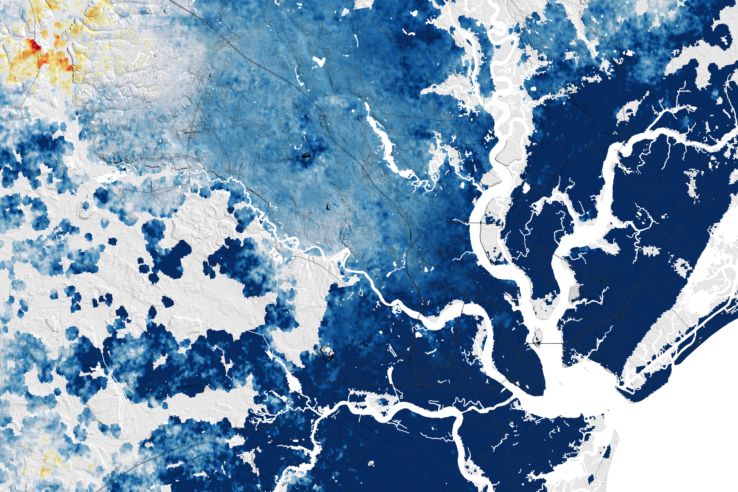
Parts of New York City and Long Island are sinking over 3 centimeters per decade.
Atlantic City is sinking up to 4 centimeters per decade. Nearby groundwater pumping has caused soils to compact.
Several hotspots in Maryland are sinking over 10 centimeters per decade, while other areas are rising. Adjacent land moving at different rates can put infrastructure at risk.
Hampton Roads, Va., which is sinking over 2 centimeters per decade, is pumping treated wastewater underground to try to slow the pace.
Charleston, S.C., which is affected by groundwater pumping, is sinking up to 5.7 centimeters per decade.
Northeast Florida has experienced some rising, up to about 1 centimeter per decade, as erosion of porous rocks has lightened the area’s weight.
Parts of Miami are sinking up to 1.5 centimeters a decade, adding to flood hazards from frequent tropical storms.
The new research from Virginia Tech and the U.S. Geological Survey used satellite data to show the mounting threats to coastal communities. Nearly 40 percent of Americans live along coasts, where aging buildings, roads and rails face structural damage from floods.
“You have a hazard that is becoming worse every day with sea level rise,” said lead author Leonard Ohenhen, Ph.D. candidate at Virginia Tech.
The global average sea level has been rising around 3.3 millimeters per year since the early 1990s, according to satellite readings from NASA. And based on longer records from tide gauges, we know that rate is accelerating, said Kenneth Miller, a professor of earth and planetary sciences at Rutgers University. Local subsidence, or sinking land, makes the threat of sea level rise worse in some places than others.
Researchers say a dominant cause for subsidence is groundwater depletion. A layer cake of overlapping aquifers extends from New Jersey to Florida along the coast, providing a reliable source of water for drinking, irrigation and industrial uses. Though the region gets regular rainfall, deeper aquifers below clay or bedrock can take hundreds or thousands of years to recharge once water is pumped out. Surface aquifers can be prone to pollution and saltwater intrusion.
Once water is removed, soils can compress and collapse, causing the land surface to sink. Cities built on drained marshland or fill are especially vulnerable to compaction.
Other forces can also influence vertical land movement: Sediments can build up at river deltas and naturally compress under their own weight. And as the weight of enormous glaciers that once extended down to New Jersey lifted after the last ice age, a seesaw effect is causing bedrock across the mid-Atlantic and South to sink by about 1 millimeter per year.
Boston should be on the rising end of that seesaw, but many areas of the city were built on soft soil prone to compaction.
To stabilize early buildings in Boston, wood pilings were driven into water-logged earth where groundwater preserved the structures. Depletion of those aquifers has exposed the wood to air in some cases, causing foundations to rot. Some homeowners have had to spend hundreds of thousands of dollars to repair the pilings to keep their homes from collapsing.
A few millimeters of sinking a year can seem gradual, but the effects can be extreme: storm surges can suddenly wash away the soil from beneath the roads, or floodwaters can fill basements and cut off emergency routes. Each inch the land slumps towards the water table can make floods significantly, catastrophically worse.
“That’s the thing about sea level [rise]. It’s slow and it’s insidious and continuous,” said Dr. Miller, at Rutgers University. That is, until the next big storm hits. “We’ve been fortunate in the past 11 years since [Hurricane] Sandy that we’ve not seen an event like that. We obviously are very likely to see similar events in the next ten years or so…”
WHRO Public Media (Feb 14, 2024):
Virginia Tech research finds East Coast cities are sinking “slowly but surely”
More than half of the infrastructure in cities like Norfolk and New York is threatened by high rates of subsidence, according to the study.
See Also:
NASA earth obervatory Image of the Day (02-20- 2024):
America’s Sinking East Coast
In many parts of the U.S. East Coast, rising seas driven by melting ice and the thermal expansion of warming water is only part of what threatens coastal areas. The land is also sinking. This geologic two-step is happening rapidly enough to threaten infrastructure, farmland, and wetlands that tens of millions of people along the coast rely upon, according to a NASA-funded team of scientists at Virginia Tech’s Earth Observation and Innovation (EOI) Lab…
Newsweek (Feb 20, 2024):
NASA Images Show Where US East Coast Is Sinking
NASA images reveal the extent to which the coast is collapsing, with some areas dropping by several millimeters per year. Using satellite data and ground-based GPS sensors, a NASA-funded team of scientists at Virginia Tech’s Earth Observation and Innovation (EOI) Lab found that the land that major cities such as New York, Baltimore, and Norfolk, Virginia, are built on sank by 1 to 2 millimeters each year between 2007 and 2020…


