Excerpt:
It is beloved by Big Sur road trippers and is vital for local businesses. But intense storms, slides and fires imperil this highway. What does the future hold?
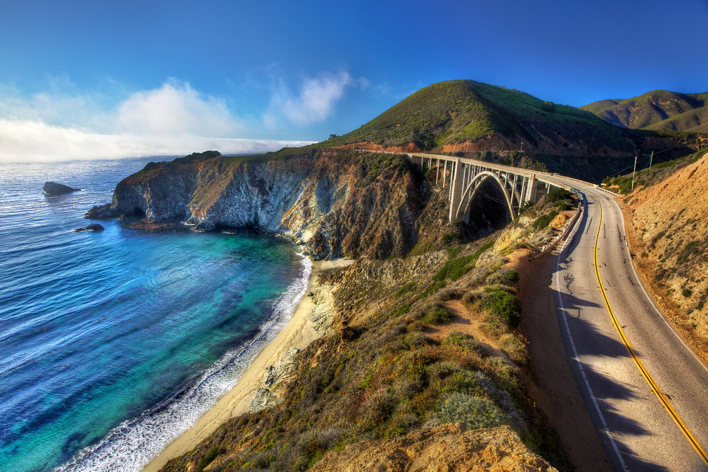
Across this stretch of the Central Coast, landslides have repeatedly buried the highway’s undulating curves or sent pavement tumbling into the Pacific Ocean. They bring a steady drumbeat of road blockages, tourism disruptions and stranded communities. Now, some fear the landslides are getting worse, due to climate change and engineering missteps throughout the roadway’s 86-year life span.
It was always a risky proposition to maintain a highway at the very edge of a continent. But now Big Sur is facing wetter storms that infiltrate and weaken cracked and porous rock. Wildfires leave behind extra debris for those floodwaters to carry downhill. Pounding waves from stronger storms and rising seas eat away at cliffs from beneath.
“Everything is working against Highway 1,” said Gary Griggs, an oceanography professor at the University of California at Santa Cruz.
The latest slip-out, known as the Rocky Creek slide, exemplifies the complexity of the problem. It stranded 1,500 people at the end of March as workers were making slow progress addressing three other slides. California’s transportation agency — known as CalTrans — estimates it will take more than $100 million to fix them all — if new slides don’t come first.
California is a national leader in confronting climate change, but making Highway 1 sustainable may be a challenge it cannot surmount. Despite spending a billion dollars a year to fix damage that climate-related stressors inflict on its roadways — plus $100 million in projects to make infrastructure more resilient to climate change — the state is struggling to fortify one of its most prized landmarks…
In older parts of the continent, such as the East Coast, rock formations are older and denser, and therefore not prone to movement. But in Big Sur, gaps and joints still exist from when the rocks first came together along the nearby San Andreas fault, and other secondary faults in the area.
This is the country’s steepest coastline outside of Alaska, according to Kevin Schmidt, another USGS geologist, and when these formations are exposed to the elements, their fragility becomes evident.
Water trickles — and sometimes pours — into the cracks between rocks, reaching layers of clay-rich rock crushed as finely as flour. It turns them into a slick slurry — a recipe for landslides.
Climate change has only juiced up those ingredients. Take what happened in 2017, when one of the region’s wettest winters in a century interrupted an extended drought.
Weeks of heavy January and February rains saturated a mountainside that was already imperceptibly sliding above Highway 1, until, by May, the instability became too much. In an instant, so much earth poured down steep slopes near Mud Creek, the USGS said, that it was enough to “fill a line of dump trucks nearly a thousand miles long.”
It took more than a year and $54 million to reconnect Big Sur communities to points south.
Though it took experts by surprise, Griggs said it shouldn’t have. Two decades earlier, CalTrans had declared the area “very active,” with “high landslide potential” due to weaker bedrock and unstable construction.
The slides often occur weeks, if not months, after rainy weather, with about 90 percent of the region’s rain typically falling between November and April. Geologists add that the stormy pattern of the last two years — the 2022-2023 winter brought record-setting amounts of precipitation — has compounded landslide risks…

