Cyclone Biparjoy: India, Pakistan evacuate more than 170,000 – BBC News
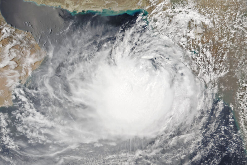
Gale force winds and heavy rains are lashing coastal parts of north-west India and southern Pakistan as a powerful cyclone makes landfall.
Forecasters say it could be the area’s worst storm in 25 years and warned it threatens homes and crops in its path.
The cyclone is due to barrel through parts of India’s Gujarat state and Sindh province in Pakistan….
El Niño and extreme Atlantic Ocean heat are about to clash – the Conversation

Globally, warm sea surface temperatures that can fuel hurricanes have been off the charts in the spring of 2023, but what really matters for Atlantic hurricanes are the ocean temperatures in two locations: the North Atlantic basin…This year, the two are in conflict – and likely to exert counteracting influences on the crucial conditions that can make or break an Atlantic hurricane season. The result could be good news…But forecasters are warning that that hurricane forecast hinges on El Niño panning out…
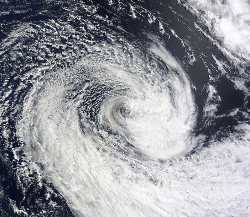
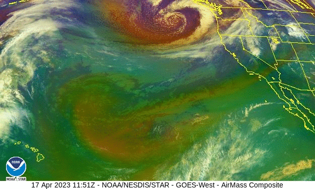
The Tiny Craft Mapping Superstorms at Sea | Interactive – the New York Times

Shortly after dawn on Sept. 30, 2021, Richard Jenkins watched a Category 4 hurricane overrun his life’s work. The North Atlantic storm was a behemoth — 50,000 feet tall and 260 miles wide. Wind circled the eye wall at 143 miles per hour; waves the size of nine-story apartment buildings tumbled through a confused sea. Puerto Rico lay 500 miles to the southwest; Bermuda was 800 miles straight ahead. Eighty miles northwest, the 23-foot boat that Jenkins had designed and built over the last decade struggled to stay upright…
Global heating has likely made El Niños and La Niñas more ‘frequent and extreme’ – the Guardian
Scientists say greenhouse gases have already affected climate patterns in the Pacific that could lead to more severe weather, floods and heatwaves…Dr Wenju Cai, lead author of the study from Australia’s CSIRO science agency, said the models showed a “human fingerprint” from 1960 onwards. But some other scientists not involved in the study had reservations about the findings, raising concerns about the reliance on modelling….
French Government Will Destroy Houses of Storm Survivors – the Epoch Times
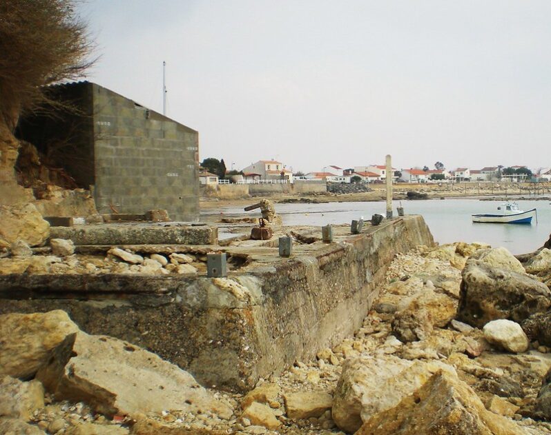
The French government has decided to stay firm on its decision to destroy more than 1,500 houses in areas of “extreme danger” along the Atlantic coast. The decision follows the deaths of 53 people from storm “Xynthia,” the violent winter storm that battered Europe’s west coast on Feb. 28. Hope had risen among residents that they could save their homes following a statement made by Interior Minister Brice Hortefeux…”There could be individual, precise, and discrete situations that could need a deepened analysis…”
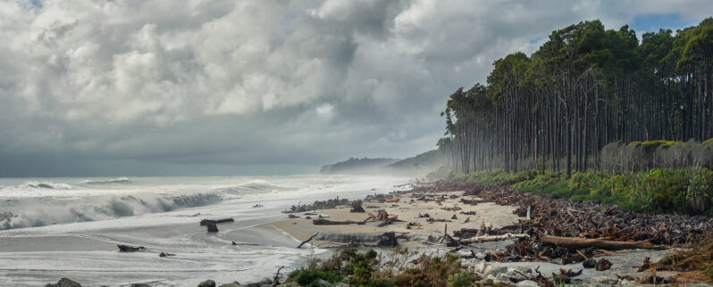
In the wake of historic storms, Māori leaders call for disaster relief and rights – Grist Magazine
In the wake of historic storms, the Māori say New Zealand must center Indigenous peoples in climate disaster plans…“Because climate events have gotten more and more intense, it’s at a point of our communities will either get wiped out through more storms or have to choose to leave their homelands,” Renee Raroa, a Ngati Porou Māori representative from Mana Taiao Tairāwhiti in eastern New Zealand, said. “We’re running out of options…”
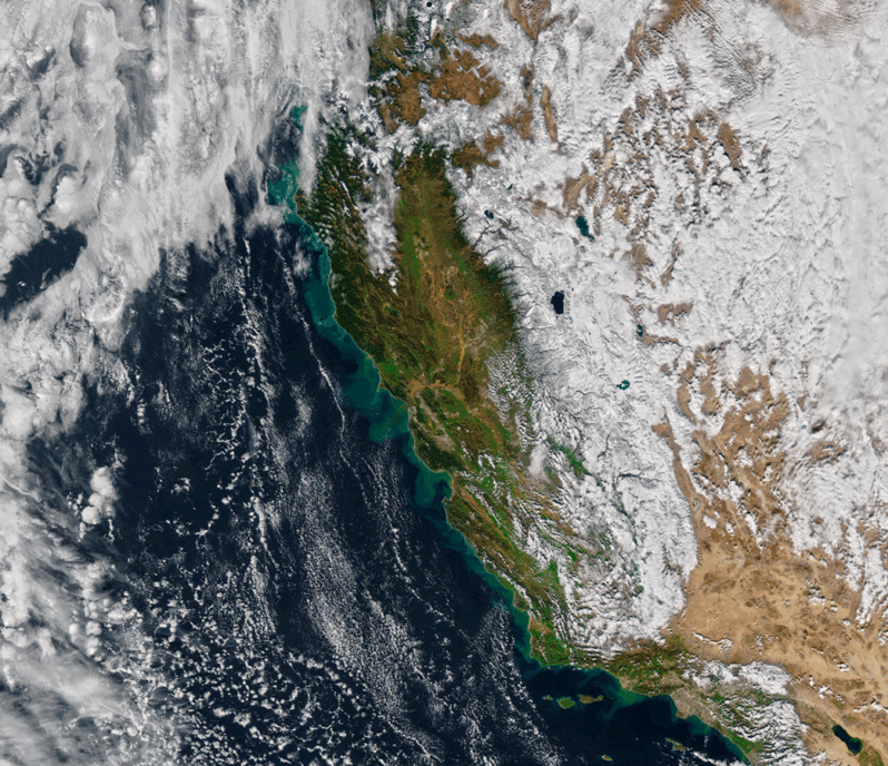
Volcano? Climate change? Bad luck? – the Los Angeles Times
As winter approached, few anticipated what was about to hit California. Mired in a serious drought, the state was suddenly battered by an onslaught of 31 atmospheric river storms in a matter of months. While the number alone isn’t exceptional, the location, intensity and duration of these storms had a transforming effect on California’s climate. Record snowfall. Deadly flooding…But one thing remains a mystery: Why did so many of these bands of water vapor, many back-to-back, slam into California?
No debate anymore: Climate change makes extreme weather worse, federal scientists say – WUSF Public Media

Scientists at the U.S. National Oceanic and Atmospheric Administration (NOAA) delivered a clear message: Climate change is — unequivocally — making extreme weather events worse.
South Florida has always been hot, rainy and vulnerable to hurricanes. So it’s understandable that some longtime residents remain skeptical that climate change is doing anything to make the region’s age-old problems any worse…
On the Coast: Before and After the Parade of Atmospheric Rivers – Planet Snapshots issue 59 via Medium
California is left drenched, flooded, and perhaps a little hopeful after recurring atmospheric rivers pummeled the state for 2 weeks straight. The rains are a small reprieve for the area’s years-long drought. But the sheer volume of rainfall was much more than the parched landscape could handle. With a turn of the faucet, the state went from too dry to too wet in what’s called a “weather whiplash,” transforming the Golden State to shades of brown…