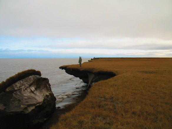

Permafrost Erosion Measurement. USGS researcher measures erosion near a collapsed block of ice-rich permafrost along Alaska’s Arctic coast. Captions Benjamin Jones USGS. Photo source: Christopher Arp, U.S. Geological Survey
Excerpts;
Thawing permafrost will have far-reaching ramifications for populated areas, infrastructure and ecosystems. A geographer from the University of Zurich reveals where it is important to confront the issue based on new permafrost maps, the most precise global maps around. They depict the global distribution of permafrost in high-resolution images and are available on Google Earth…
Read Full Article, Science Daily
Alaskan Permafrost Mapped from the Skies, USGRP
Last week, the Interior Department’s US Geological Survey (USGS) released details about a landmark airborne survey of permafrost in the Yukon Flats of Alaska that yielded some of the most detailed, data-rich maps of permafrost ever generated. Permafrost—frozen ground that remains at or below water’s freezing point for at least two years—accounts for only 0.022% of all water on Earth, but it covers more than 20% of exposed land of Earth’s northern high latitudes (in addition to areas of Antarctica and the Patagonia region), where it plays a potentially important role in climate dynamics.
There are many reasons scientists seek to understand where permafrost is and how it is changing. One reason is that changes in permafrost can impact ground stability, affecting infrastructure such as roads, home foundations, water treatment facilities, and industrial sites. Another is that it changes in response to changes in temperature and water systems, and so is a key indicator of climate change…