Photograph courtesy of Mark Edward Harris
Excerpts
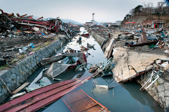
Japan’s recent massive earthquake, one of the largest ever recorded, appears to have moved the island by about eight feet (2.4 meters), the US Geological Survey said.
Japan Quake May Have Slightly Shortened Earth Days, Moved Axis, Science Daily

This National Oceanic and Atmospheric Administration (NOAA) Global bathymetry map image released on March 11, 2011 shows features of the ocean floor depth (or bathymetry) from a NOAA ETOPO-1 dataset. The image shows the entire Western Pacific basin. Notice how abruptly the Japanese islands rise out of the ocean. Other coastal Asian areas have much more gradual slopes. The islands and mountain ranges throughout the ocean, visible in this imagery, also affect the tsunami travel time and speed. In the open ocean, tsunamis can travel at speeds up to 500 mph (800 kph). This momentum is what creates such a destructive force as the wave moves inland. (NOAA)


