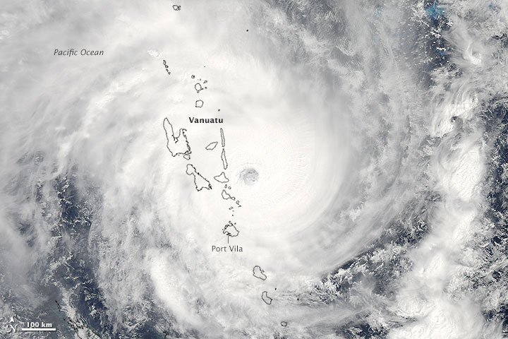
Cyclone Pam was heading in a southwesterly direction when the Moderate Resolution Imaging Spectroradiometer (MODIS) on NASA’s Aqua satellite acquired this image at 1:30 p.m. local time (2:20 Universal Time) on March 13, 2015. Not long after the image was acquired, the storm struck the island of Efate, which is home to Vanuatu’s capital city, Port Vila. Captions and Photo source: NASA / earth Observatory
Excerpts;
Relief workers reported “unbelievable destruction” after Tropical Cyclone Pam smashed the capital of Vanuatu, the Australian Red Cross said Saturday…
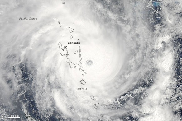
On the same day, another major tropical cyclone—Category 3 Olwyn—made landfall in Western Australia near the city of Carnarvon. It has been an unusually busy week for tropical cyclones in the vicinity of Australia…
Like a bomb’s gone off’: Cyclone hits Vanuatu dead-on, USA Today
Cyclone Pam, possibly the worst cyclone in the Pacific’s history, slammed directly into the tiny South Pacific archipelago Vanuatu early Saturday, killing at least eight people and leaving thousands homeless, according to reports from aid organizations.
Cyclones Thrash Vanuatu and Western Australia, NASA / Earth Observatory
On the same day, another major tropical cyclone—Category 3 Olwyn—made landfall in Western Australia near the city of Carnarvon. The lower image was acquired at 10:55 am local time (2:55 UTC) by the MODIS on NASA’s Terra satellite. Thousands of people in Carnarvon lost power as a result of the storm, which weakened as it pushed inland. It has been an unusually busy week for tropical cyclones in the vicinity of Australia…
Powerful Cyclone Pam Hits Tiny Nation of Vanuatu, CBS News (03-13-2015)


