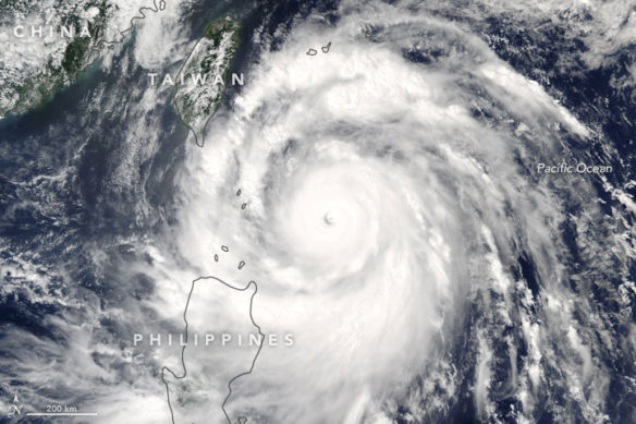
Super Typhoon Meranti neared Taiwan on September 13, 2016. The Moderate Resolution Imaging Spectroradiometer (MODIS) on NASA’s Aqua satellite acquired this natural-color image the same day. At the time, Meranti was a category 5 storm with wind speeds of roughly 160 knots (184mph). Captions and image source: NASA / Earth Observatory
Excerpts;
As Super Typhoon Meranti roars toward Taiwan and mainland China, officials and residents are preparing for the worst of the storm, which has become the most powerful of 2016…
Read Full Article, Weather News (09-13-2016)
Super Typhoon Meranti; NASA / Earth Observatory (09-14-2016)
Forecasters expect the storm to skirt the southern tip of Taiwan in the morning hours of September 14. The U.S. Navy’s Joint Typhoon Warning Center (JTWC) predicts maximum open-ocean waves of 48 feet and sustained winds of 150 knots (173 miles per hour), with gusts up to 180 knots (207 mph) as Mernati passes Taiwan. While the eye of the storm won’t hit Taiwan directly, the island will take the brunt of the right side of the storm…