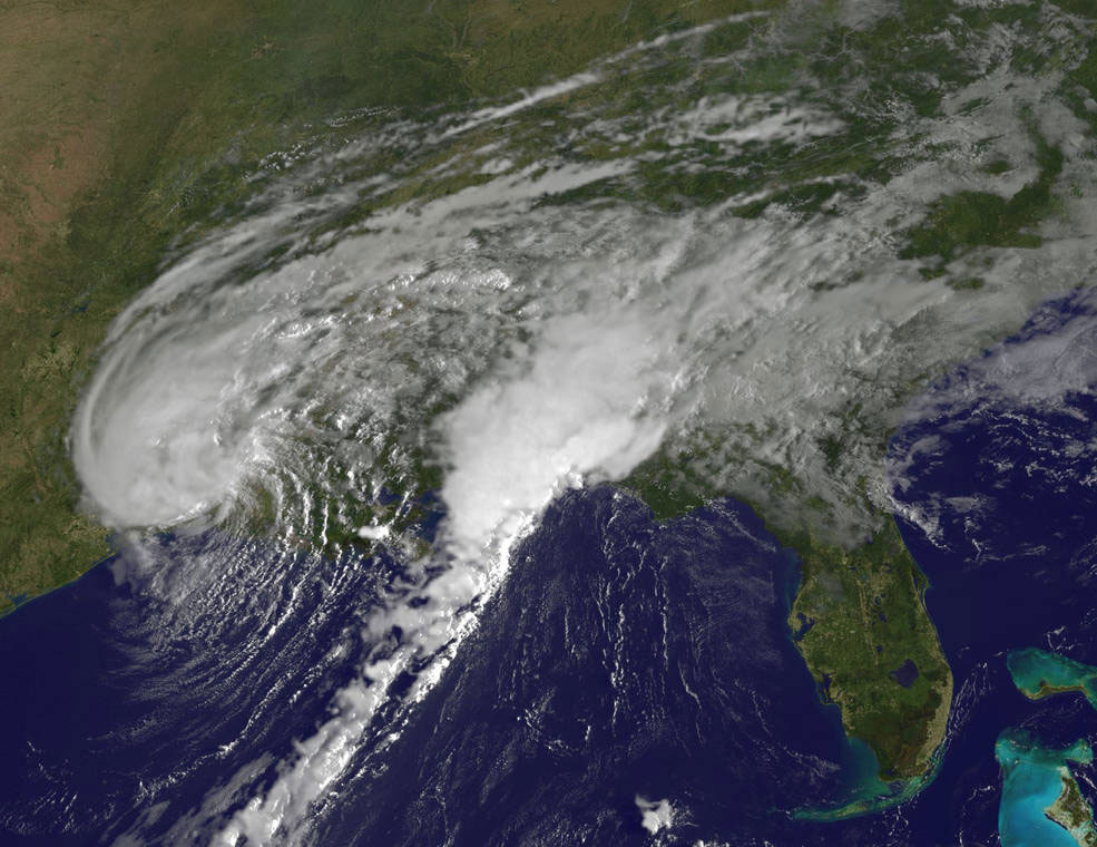

NOAA’s GOES-East satellite provided a visible-light image of Tropical Storm Harvey on Wednesday, August 30, 2017 at 7:30 a.m. EDT (1230 UTC) after it made landfall at 4 a.m. CDT just west of Cameron, Louisiana. Credits: NASA/NOAA GOES Project
Excerpts;
NHC said Harvey is expected to produce additional rainfall accumulations of 3 to 6 inches from southwestern Louisiana and the adjacent border of eastern Texas northeastward into western Kentucky through Friday with isolated amounts up to 10 inches. The expected heavy rains spreading northeastward from Louisiana into western Kentucky may also lead to flash flooding and increased river and small stream flooding.
The National Hurricane Center (NHC) said a Storm Surge Warning is in effect for Holly Beach, Louisiana to Morgan City, Louisiana. A Storm Surge Watch is in effect from east of High Island, Texas to west of Holly Beach, Louisiana…


