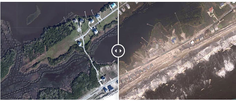

“Before” images are provided by Mapbox, Digital Globe, and OpenStreetMap; “After” images were captured by NOAA’s National Geodetic Survey in the aftermath of Hurricane Florence. View tips on how to use the imagery viewer. NOAA
Excerpts;
Aerial images captured the destruction Hurricane Florence inflicted on the North Carolina coastline, from lines of houses shorn of their shingles to sand-covered streets…
Read Full Article; CNN (09-19-2018)
Learn More, NOAA (09-19-2018)
The National Geodetic Survey (NGS) is now collecting damage assessment imagery in the aftermath of Hurricane Florence. Images are updated every 12 hours, which includes flight and processing time.
NOAA’s aerial imagery aids safe navigation and captures damage to coastal areas caused by a storm. Aerial imagery is a crucial tool to determine the extent of the damage inflicted by flooding, and to compare baseline coastal areas to assess the damage to major ports and waterways, coastlines, critical infrastructure, and coastal communities…


