Excerpt:
Multiple new studies highlight a rate of sea level rise that is ‘unprecedented in at least 120 years’ along the Gulf of Mexico and southeastern U.S. coast.
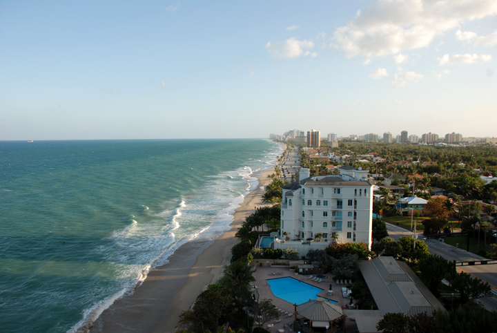
Scientists have documented an abnormal and dramatic surge in sea levels along the U.S. gulf and southeastern coastlines since about 2010, raising new questions about whether New Orleans, Miami, Houston and other coastal communities might be even more at risk from rising seas than once predicted.
The increase has already had major effects, researchers found. One study suggests that recent devastating hurricanes, including Michael in 2018 and Ian last year, were made considerably worse by a faster-rising ocean. Federal tide gauge data from the National Oceanic and Atmospheric Administration suggest that the sea level, as measured by tide gauge at Lake Pontchartrain in New Orleans, is eight inches higher than it was in 2006, just after Hurricane Katrina.
“The entire Southeast coast and the Gulf Coast is feeling the impact of the sea level rise acceleration,” said Jianjun Yin, a climate scientist at the University of Arizona and the author of one of two academic studies published in recent weeks that describe the changes.
Yin’s study, published in the Journal of Climate, calculates the rate of sea-level rise since 2010 at more than 10 millimeters — or one centimeter — per year in the region, or nearly 5 inches in total through 2022. That is more than double the global average rate of about 4.5 millimeters per year since 2010, based on satellite observations of sea level from experts at the University of Colorado at Boulder.
While the annual totals might sound minor, even small changes in sea levels over time can have destructive consequences. Yin’s study suggested that Hurricanes Michael and Ian, two of the strongest storms ever to hit the United States, were made considerably worse in part from additional sea level rise.
“It turns out that the water level associated with Hurricane Ian was the highest on record due to the combined effect of sea-level rise and storm surge,” Yin said…


