Excerpt:
Faced with an eroding beach, Oak Island wants to pump fresh sand onto its oceanfront. But finding a viable sand source might mean going a long way offshore
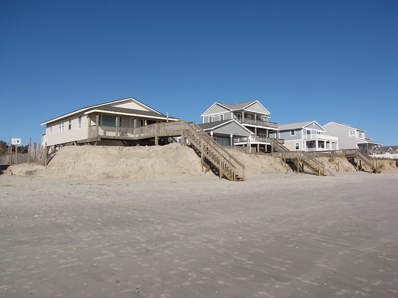
Not for the first time, the west end of Oak Island needs sand.
Hurricane Isaias, which raked the Brunswick County shoreline nearly four years ago, chewed away a lot of the beach. Storms, king tides and gradual sea-level rise has since then added to the pain.
But there isn’t enough available beach-compatible material near shore, or sand that isn’t already planned for other projects, to support a large-scale nourishment.
That has Oak Island officials eyeing a 250-acre borrow site as far out as where gigantic energy-producing offshore wind turbines are planned to help stabilize and rebuild much of the town’s beach even as they also potentially look toward a more permanent solution for the erosion-prone area near Lockwood Folly Inlet − namely a terminal groin.
On Feb. 2, the Brunswick County beach town submitted a permit application to the U.S. Army Corps of Engineers’ Wilmington district office seeking approval for a project this winter to stabilize and rebuild much of the beach’s dune line. The offshore borrow site would be the primary source for the proposed 3 million cubic yards of material, with sand from the mouth of the Cape Fear River, dredged by the corps as part of the Wilmington Harbor project, as a potential secondary source.
“The proposed project is primarily a berm designed to provide advanced fill for a 6-year renourishment interval,” states the town’s application.
But what makes this project potentially unique, and expensive, is where Oak Island is eyeing to get the majority of its sand. The island is looking at mining a borrow site roughly 18 miles offshore as the primary source for sand. That will require the sand to be mined and transported close to shore by a hopper dredge before it can be placed onto the beach, a much more expensive method than simply pumping sand via pipes from nearby channels or inlets onto a beach.
To put that in perspective, sand for the federally funded Wrightsville Beach nourishment project that is currently wrapping up came from Masonboro Inlet after a prolonged tug-of-war with federal and environmental officials over using sand from a site in a Coastal Barrier Resources Area (CBRA) zone. If that appeal by the town had failed, it was eyeing a borrow site roughly three miles offshore.
Farther up the coast, Topsail Beach used sand from New Topsail Inlet and nearby channels for its roughly $25 million project this winter.
Because the proposed Oak Island sand source is in federal waters, beyond the three-mile jurisdictional limit of North Carolina’s state waters, the federal Bureau of Ocean Energy Management (BOEM) is coordinating with the Corps on the application review…


