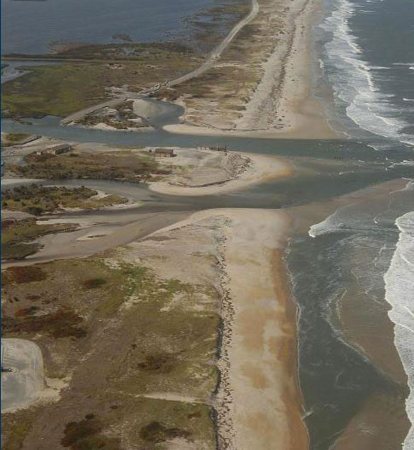

Oblique aerial photograph of Pea Island National Wildlife Refuge, NC, looking north along the coast on August 30, 2011, three days after landfall of Hurricane Irene. Caption and photo source: USGS.
Excerpts;
Last August, when Hurricane Irene sliced across the Outer Banks, it cut Highway 12, Hatteras Island’s lifeline, in two places. Engineers rushed to repair the damage, filling and repaving a washed-out stretch of roadway here and building a bridge over a newly formed inlet a few miles to the north.
The road reopened on Oct. 11, to the cheers of anglers, would-be vacationers and the innkeepers, restaurateurs and merchants whose livelihoods had taken a huge blow.
But the winds and waves that shape the coast were already gnawing at the new bridge. By January, engineers were reinforcing its southern approach with sandbags and rock trucked in from the mainland, in hopes of keeping the road open until a more permanent fix could be designed and built…


