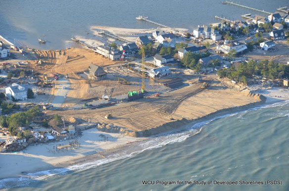

Mantoloking, New Jersey. Aerial pictures of New Jersey’s coast, after superstorm Sandy devastated the area. Photo courtesy of: © Program for the Study of Developed Shorelines (PSDS) / WCU
Captions By Andy Coburn, Associate Director, Program for the Study of Developed Shorelines / Western Carolina University,
“Based on a cursory examination, the hardest hit area (in terms of property damage from storm surge) is the New Jersey shoreline between Seaside Park and Mantoloking.
Other areas, including the southern-facing beaches of western New York, also sustained significant property damage. Although the damage is unprecedented for this area, it is consistent with what we would expect from a Category 1 Hurricane creating a 10-12 foot storm surge (we’ll know more details about this in the coming weeks).
There are a number of things we hope to do with these images including ascertain if beach nourishment/dune reconstruction projects had any influence on the degree and extent of property damage.”
Questions, comments, problems, requests and permission to reproduce images should be directed to Andrew S. Coburn
View Most Recent: Post Sandy: Aerial Images of New Jersey and NY Shoreline, PSDS Photos Gallery
Atlantic City to Cape May and DE Bay shore, PSDS Photos Gallery, Picassa Web
Ocean City MD to Parramore Island VA, PSDS Photos Gallery, Picassa Web
VA Cedar Island and Parramore Island, PSDS Photos Gallery, Picassa Web
Program for the Study of Developed Shorelines (PSDS), Western Carolina University


