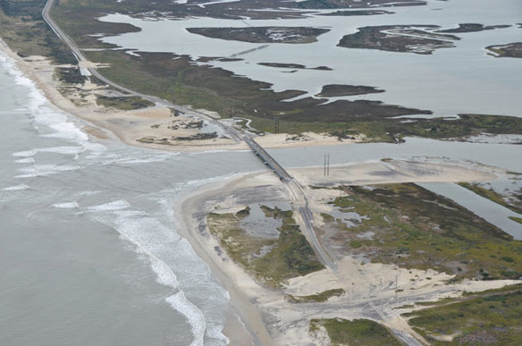

Aerial pictures of North Carolina’s coast, Highway NC 12, after superstorm Sandy devastated the area. Photo courtesy of: © Program for the Study of Developed Shorelines (PSDS) / WCU
Excerpts;
Sound-side storm surge, expected to be as high as six feet along the Outer Banks, was not as serious as forecast Monday night, when winds from Hurricane Sandy shifted and threatened the backsides of the barrier islands…
The ocean flooded neighborhoods, covered N.C. 12 and felled a pier along the Outer Banks as Hurricane Sandy went by. Hatteras Island is once again cut off from the rest of the world…


