Excerpt:
With more than a quarter of its land below sea level, the Netherlands has been going to great lengths to protect itself from the impacts of climate change, including sea level rise and extreme weather events like heavy rain. But even with the wealth and experience to address these issues, the future remains uncertain, mainly because a range of possible scenarios could play out after 2050.
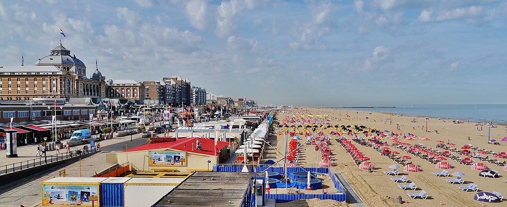
A misty rain blows against my face as I follow Farah Obaidullah along Scheveningen Beach in the northwest part of The Hague. Despite the wind and drizzle, the shoreline feels calm. Gray waves roll into the sand like long, deep breaths. Machines have raked the beach into a well-manicured carpet of grains and shell fragments.
But about a year ago, in February 2022, Scheveningen looked very different as Storm Eunice battered the coastline with high-speed winds and fierce waves.
“The sea was amazing — just how wild it gets and how ferocious,” says Obaidullah, who strides quickly over the beach, an old Greenpeace beanie pulled over her bobbed curls. “You don’t really want to be out near the sea at that time. But I walked outside in the aftermath of Eunice, and the sand had literally taken over the boulevard and the beach bars.”
Storm Eunice ravaged the Netherlands with winds of up to 128 kilometers per hour (80 miles per hour) and sea levels reaching 2.2 meters (7.2 feet) above their normal height. It damaged buildings, toppled trees and killed three people. But while the sand blew across the coast, the tide and storm surge never reached the town of Scheveningen’s infrastructure, thanks to interventions made a couple of decades ago in anticipation of sea level rise and extreme weather events like this.
n 2003, experts identified the Scheveningen shoreline as one of several “weak links” in the Dutch coastal defense against sea level rise. This awareness led to a $70 million reconstruction project to protect Scheveningen and the rest of The Hague, a city of half a million residents that is the seat of the Dutch government (though, curiously, not its capital) and the United Nations’ International Court of Justice, and home to the royal family. The modifications included raising Scheveningen’s dike to be 10 m (33 ft) over NAP, for Normaal Amsterdams Peil, meaning normal water level in Amsterdam. The NAP is the baseline for measuring seawater levels all across the Netherlands, and is approximately equal to the average level of the North Sea. Additionally, workers installed nearly 2.4 million cubic meters (85 million cubic feet) of dredged sand on the beach to push the ocean back 50 m (164 ft) from the shoreline and to raise the sandbank 4.5 m (15 ft) above NAP.
Obaidullah, who’s lived in the area on and off since 1980, remembers a different Scheveningen from her childhood. Before our beach walk, she opened a photo album on her dining table and showed me pictures of the old shoreline. Back then, the tides came up to the promenade.
“I can see very clearly that the beach is much narrower than it is today,” said Obaidullah, an independent oceans campaigner and founding director of the nonprofit Women4Oceans. “The water is pretty much coming up until the boulevard…”


