Excerpt:
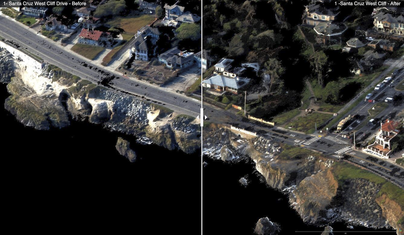
The USGS has collected and released topographic data that show the erosional effects of the January 2023 storms on the coast for the Santa Cruz region of California.
These data were developed from photographs collected in partnership with Ecoscan Resource Data during the afternoon of January 5th, 2023. Photos have been processed with a digital technique called structure-from-motion photogrammetry to make accurate orthomosaics of the coastal landscape. Comparing the data with pre-storm conditions mapped in September 2022 provide “before” and “after” perspectives of the effects of the January storms. These data have been released under USGS Emergency Use Data authorities for data that have immediate or time-sensitive relevance to public health and safety.
The images below show views of the Santa Cruz, California coast before (Sept. 13, 2022) and after (Jan. 5, 2023) the powerful storms of early January 2023. Images show views of the 3-dimensional landscape data derived by USGS photogrammetry techniques….


