


By Dr. Joe Kelley, Department of Earth Sciences, University of Maine
Quendale Beach is on the southern side Mainland, the largest of island in the Shetlands. The Shetland Islands, of course, are a part of Scotland, though they are usually shown on an inset map of the UK because they are farther north than parts of Norway. This is a treeless landscape with strong winds and large waves during storms. Swimming is possible, but the water is cold and a wetsuit is advised even in the summer.
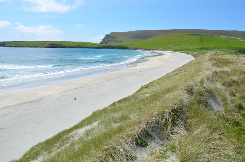
The Quendale Beach is a beautiful and tranquil, however, with visitors who prefer solitude to glitz (Figure 1). It is a clean sand beach about a kilometer (little over a half mile) long. There are rocky headlands at either end, with scattered farms and archeological sites, and no commercial development near the beach. It is easily reached by a dirt road through gated sheep farms, but the sheep and farmers are friendly and welcoming.
… Possibly owing to frequent large storms during the climatic event known as The Little Ice Age, or overgrazing by introduced sheep and rabbits, the sand dunes broke down and wind-blown sand swept across the area. The nearby community was overwhelmed by sand, described by a visitor as another “Arabia”…..
—Dr. Joe Kelley
Sand dunes up to 15 m (50 feet) high back the landward margin of the beach (Figure 2), but a path through them was cut to permit easy access. The dunes appear to be eroding today, but enough sand remains in most places to insure a long and stable future. One exception is a dreadful area where sand mining occurred in the back dunes in the 1970’s. Half a million to a million cubic yards of sand were unwisely extracted, reducing the back dune elevation to the water table for more than a hundred meters (Figure 3). Generally this area is used for parking and informal camping (typically by touring bicyclists) today.
Though it is bucolic today, two historic events marred the tranquility of the region. In 1969, the oil tanker MS Braer crashed against the rocks nearby, releasing 85,000 tons of crude oil. This was an extraordinary disaster, but an ambitious clean up, big storms and time have completely healed the beach. Today, no oil whatsoever can be seen, and shorebirds like gannets, razorbills and puffins abound on the cliffs.
The other act of violence against the calm of the area occurred in the late 17th Century. At that time, the valley behind the Quendale Beach was among the most valuable and productive farmland on the island. Possibly owing to frequent large storms during the climatic event known as the Little Ice Age, or overgrazing by introduced sheep and rabbits, the sand dunes broke down and wind-blown sand swept across the area. The nearby community was overwhelmed by sand, described by a visitor as another “Arabia”.
Houses and eventually the entire settlement was abandoned as migrating sand and dunes eventually buried everything. The community was literally removed from the map by the disaster. Today, archaeologists are digging through the sands to glimpse remains of life from that period (Figure 4).


